aria.quick_link.navi aria.quick_link.skiptomaincontent aria.quick_link.footer
Garda Trentino Logo
Top

Garda Trek - Alto Circuit 1: from Riva del Garda to Rifugio Pernici

Riva del Garda, Ledro

Category
Difficulty
Difficult
Duration
7:00
Duration in hours
Distance
13.7
Distance in km
Status
open
Suggested period
Jan
Feb
Mar
Apr
May
Jun
Jul
Aug
Sep
Oct
Nov
Dec

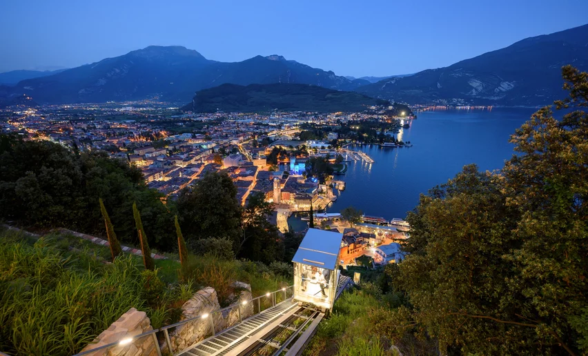
This stage includes almost 1600 meters of elevation gain, from the Mediterranean shores of Lake Garda to the alpine peaks between Garda Trentino and the Ledro Valley. 

The first stage of Garda Trek takes you from the Mediterranean environment of the center of Riva del Garda to the alpine environment of the ridges, which lead you step by step to the alpine hut Rifugio Pernici.

This path starts with a very demanding section, quickly gaining altitude as you face the steep slopes of Monte Rocchetta on path SAT 418. The elevation change is about 1550 m, but it is worth it because you can enjoy fabulous views on both sides once you reach the ridge. 

Note that along the route there are no places to replenish food or drinks. So bring plenty of water and snacks with you.

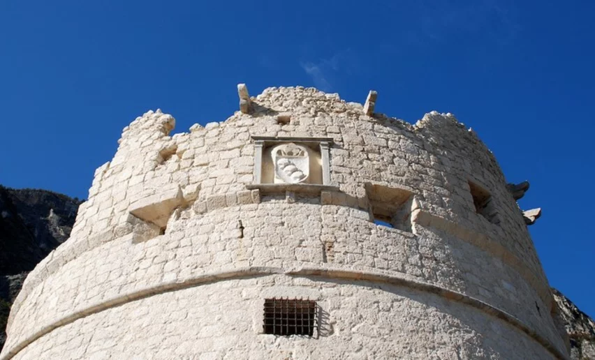
Near the Rifugio Pernici, you can find some trenches dating back to the First World War. This was in fact part of the Austrian defensive line. The building that now houses the hut was built during that period as an officers’ cellar.

Further information and useful links
You have chosen the perfect route – now make sure you are ready to enjoy it to the fullest. Local hiking experts are here to help you: guides, shops and specialists with advice and support for every step of the way.
details
  • Multi-stage route
  • Scenic
  • Summit route
Route info
Difficult
Route number
Distance
13,7 km
Duration
7 h 00 min
Altitude difference (+)
1.822 m
Altitude difference (-)
317 m
Physical effort
Scenary
Highest point
1.794 m
Lowest point
88 m
Suggestions

At the Pernici hut you absolutely must try the potato polenta: a hearty dish ideal for regaining strength after the hike.

If you want to return to Riva del Garda after staying overnight at the hut, we recommend this route: SAT 402 path, the “pinza” path: outside the hut take SAT 402 which descends towards Riva del Garda. The path crosses Campi and then joins the old “pinza” road, one of the ancient communication routes in Garda Trentino. Near Riva del Garda, the paths pass close to the ruins of San Giovanni and the chapel of Santa Maria Maddalena; once you reach the fork with SAT 404 you can choose to continue towards Bastione to enjoy the wonderful lake view or descend directly towards the town center.

You might be interested in
Discover related tours
© fototeca trentino sviluppo foto di G. Caproni, North Lake Garda Trentino
Intermediate
Tenno, Comano, Arco
Sentiero Frassati - Leg 2
Distance 23,3 km
Duration 8 h 40 min
Altitude difference (+) 800 m
Altitude difference (-) 1.219 m
Status
open
Lake Tenno | © Archivio Garda Trentino (ph. Watchsome), Garda Trentino
Intermediate
Riva del Garda, Tenno
GardaTrek - Top Loop 2: descent to Lake Tenno
Distance 11,6 km
Duration 5 h 00 min
Altitude difference (+) 678 m
Altitude difference (-) 1.305 m
Status
closed
View from BoscoArteStenico to Stenico Castle | © Archivio Garda Trentino (ph. M. Corradi), North Lake Garda Trentino
Difficult
Valle dei Laghi, Comano
Cammino di San Vili - High itinerary
Distance 92,7 km
Duration 40 h 00 min
Altitude difference (+) 4.259 m
Altitude difference (-) 5.596 m
Status
open
Lake Toblino | © Armin Huber, Garda Trentino
Difficult
Valle dei Laghi, Comano
Cammino San Vili - low itinerary
Distance 107,6 km
Duration 35 h 00 min
Altitude difference (+) 3.228 m
Altitude difference (-) 4.553 m
Status
open
part of the San Rocco route | © camminosanrocco.it, APT Rovereto Vallagarina Monte Baldo
Difficult
Surroundings, Val di Gresta, Arco
The San Rocco Path
Distance 67,4 km
Duration 23 h 25 min
Altitude difference (+) 3.157 m
Altitude difference (-) 3.156 m
Status
open
On Mount Baldo | © Archivio Garda Trentino - Ph. G. P. Calzà, North Lake Garda Trentino
Intermediate
Surroundings, Torbole sul Garda - Nago
GardaTrek - Top Loop 7: Back to the water
Distance 7,6 km
Duration 2 h 50 min
Altitude difference (+) 345 m
Altitude difference (-) 655 m
Status
open