aria.quick_link.navi aria.quick_link.skiptomaincontent aria.quick_link.footer
Garda Trentino Logo
Top

19. Marmitte, Castel Penede and Strada Santa Lucia

Torbole sul Garda - Nago

Category
Difficulty
Easy
Duration
2:00
Duration in hours
Distance
5.8
Distance in km
Status
open
Suggested period
Jan
Feb
Mar
Apr
May
Jun
Jul
Aug
Sep
Oct
Nov
Dec

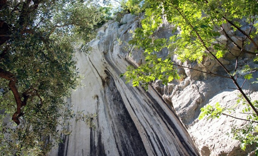
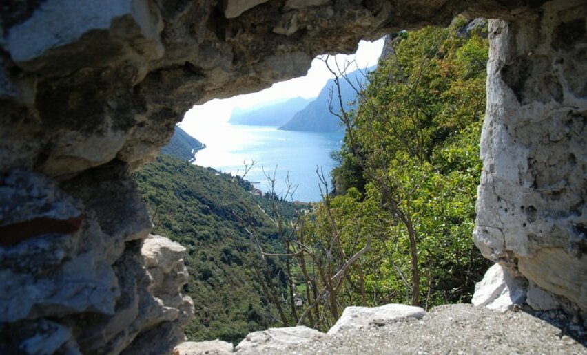
An easy hike through historic locations with a marvellous view over Lake Garda

Would you like to relive the feelings of the great German poet Goethe when he first looked out over Lake Garda? This trek follows in his footsteps on the historic Strada di Santa Lucia trail with the addition of an interesting stop-off to visit the ruins of Castel Penede.

Can you imagine massive Venetian galleys being hauled over the mountains? Well, in 1439, this is precisely what happened. Brescia, an ally of Venice, was under threat from the Milanese troops and intervention was needed in their defence. The Venetians sailed up the River Adige with 25 boats and 6 galleys which were dismantled and transported with the help of 2000 oxen to the port of Torbole, passing through the Santa Lucia valley. In 1440 the little fleet defeated the Milanese and liberated Riva del Garda.

Further information and useful links
You’ve picked the perfect trail – now make sure you’re ready to enjoy it to the fullest. Local hiking specialists are here to help: guides, shops and experts with the tips and support you need for every step of the way.
details
  • Scenic
  • Geological highlights
  • Round trip
  • Family-friendly
  • Cultural/historical interest
Route info
Easy
Route number
Distance
5,8 km
Duration
2 h 00 min
Altitude difference (+)
222 m
Altitude difference (-)
221 m
Physical effort
Scenary
Highest point
260 m
Lowest point
66 m
Suggestions

The old road of Santa Lucia, a trail of Roman origin decending at the foot of the cliff of Castel Penede, was for centuries the only road between Nago and Torbole.

You might be interested in
Discover related tours
© M. Corradi, North Lake Garda Trentino
Easy
Comano
“BoscoArteStenico” path
Distance 2,2 km
Duration 1 h 10 min
Altitude difference (+) 66 m
Altitude difference (-) 57 m
Status
open
View of the Arco castle | © Archivio Garda Trentino (ph. Watchsome), Garda Trentino
Easy
Arco
The Dürer Promenade in Arco
Distance 7,6 km
Duration 2 h 21 min
Altitude difference (+) 212 m
Altitude difference (-) 212 m
Status
open
Trail bulletin board | © APT Terme di Comano Dolomiti di Brenta, North Lake Garda Trentino
Easy
Comano
“La strada delle streghe” path
Distance 2,6 km
Duration 1 h 15 min
Altitude difference (+) 107 m
Altitude difference (-) 115 m
Status
open
© APT Terme di Comano Dolomiti di Brenta, North Lake Garda Trentino
Easy
Comano
"Il Pifferaio magico e le palafitte" path
Distance 4,0 km
Duration 1 h 30 min
Altitude difference (+) 38 m
Altitude difference (-) 36 m
Status
open
Between Pieve and Mezzolago | © Voglino e Porporato, Garda Trentino
Easy
Ledro
Lakeside walk
Distance 9,8 km
Duration 1 h 30 min
Altitude difference (+) 201 m
Altitude difference (-) 201 m
Status
open
Open-air gallery near Drena | © Archivio Garda Trentino (ph. Marco Giacomello), Garda Trentino
Easy
Dro & Drena, Arco
Open Air Gallery: art in the open air in Drena
Distance 0,8 km
Duration 21 min
Altitude difference (+) 54 m
Altitude difference (-) 53 m
Status
open