aria.quick_link.navi aria.quick_link.skiptomaincontent aria.quick_link.footer
Garda Trentino Logo
Top

Bastione - S. Maria Maddalena - Foci San Giacomo

Riva del Garda

Category
Difficulty
Intermediate
Duration
1:30
Duration in hours
Distance
4.3
Distance in km
Status
open
Suggested period
Jan
Feb
Mar
Apr
May
Jun
Jul
Aug
Sep
Oct
Nov
Dec

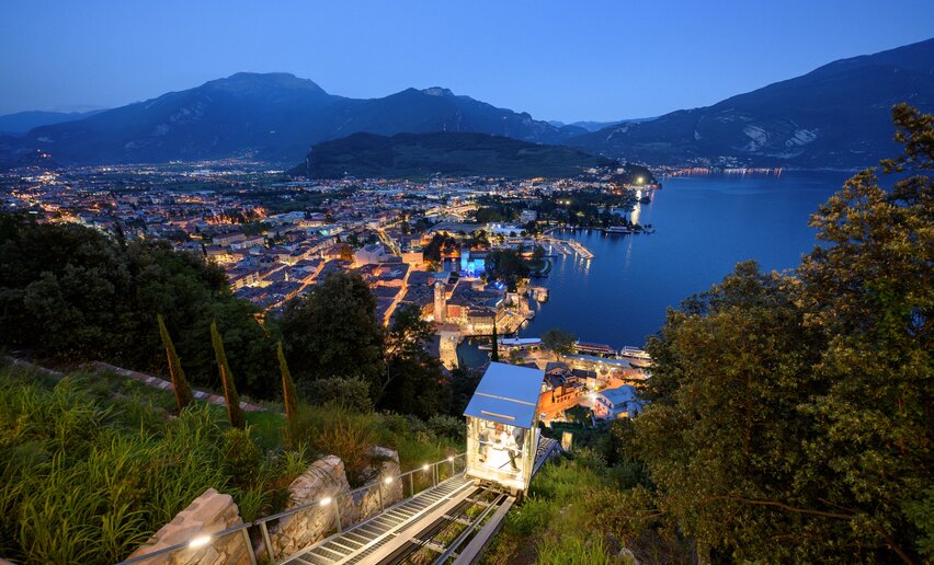
Short and easy walk to discover an almost unknown area of Riva del Garda.  

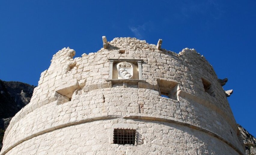
Passed the Bastione, the tower with view over Riva del Garda, the tour enters an unpolluted and little attended area of the city. The little Church of Santa Maria Maddalena is a jewel wrapped by the luxuriant vegetation. The path continues through a holm oak wood until foci San Giacomo, where Torrent Albola descend from the mountains above to end in Lake Garda.

Further information and useful links
You’ve picked the perfect trail – now make sure you’re ready to enjoy it to the fullest. Local hiking specialists are here to help: guides, shops and experts with the tips and support you need for every step of the way.
Route info
Intermediate
Route number
Distance
4,3 km
Duration
1 h 30 min
Altitude difference (+)
215 m
Altitude difference (-)
219 m
Physical effort
Scenary
Highest point
269 m
Lowest point
82 m
Suggestions

The origin of the Church of Santa Maria Maddalena dates back to the IV century. Beside the church there are the ruins of an arcade and a retreat.  

You might be interested in
Discover related tours
© Fototeca Trentino Sviluppo foto di A. Russolo, Garda Trentino
Easy
Comano
S. Croce church: at the foot of Monte Casale
Distance 5,6 km
Duration 2 h 30 min
Altitude difference (+) 263 m
Altitude difference (-) 262 m
Status
open
View of Arco castle | © Archivio Garda Trentino (ph. Watchsome), Garda Trentino
Easy
Arco
The Dürer Promenade in Arco
Distance 7,6 km
Duration 2 h 21 min
Altitude difference (+) 212 m
Altitude difference (-) 212 m
Status
open
© Stefania Oradini, Garda Trentino
Easy
Ledro
Exploring Ledro Land Art
Distance 2,6 km
Duration 1 h 00 min
Altitude difference (+) 67 m
Altitude difference (-) 67 m
Status
open
© Fototeca Trentino Sviluppo foto di A. Russolo, Garda Trentino
Easy
Comano
Potato Trail
Distance 7,6 km
Duration 1 h 45 min
Altitude difference (+) 199 m
Altitude difference (-) 199 m
Status
open
© Silvia Ricca, Trentino Sviluppo foto di B. Bolchi
Easy
Comano
Campo Lomaso, the Roman Bridge and Castel Spine
Distance 7,2 km
Duration 2 h 07 min
Altitude difference (+) 177 m
Altitude difference (-) 157 m
Status
open
© APT Terme di Comano Dolomiti di Brenta, North Lake Garda Trentino
Easy
Comano
“La strada delle streghe” path
Distance 2,6 km
Duration 1 h 15 min
Altitude difference (+) 107 m
Altitude difference (-) 115 m
Status
open