Logo Garda
Top

Via Ferrata dell’Amicizia - Cima SAT

Riva del Garda
Category
Difficulty
Intermediate
Duration
4:00
Duration in hours
Distance
4
Distance in km
Status
open
WSEN
Suggested period
Jan
Feb
Mar
Apr
May
Jun
Jul
Aug
Sep
Oct
Nov
Dec

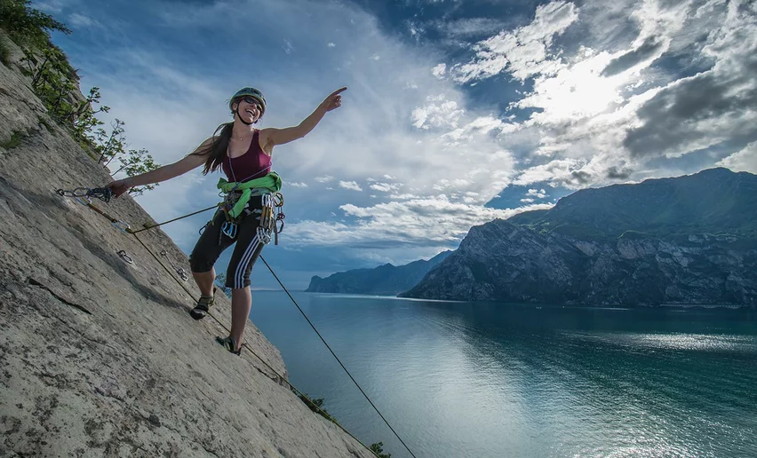
Created in 1972 to celebrate the Centenery of SAT – the Trento Alpine Association – this ferrata is famous for its series of long vertical ladders.

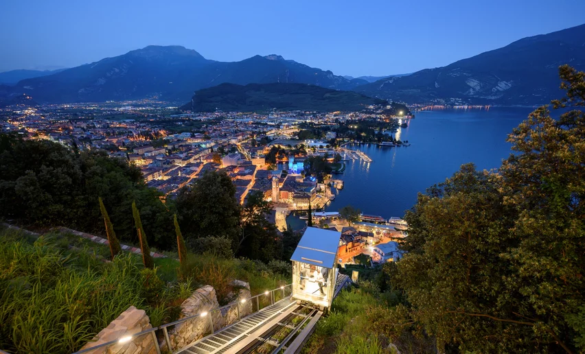
As you head off from the centre of Riva del Garda towards the base of the ferrata, you can see the walls you are about to scale rising sheer above you.

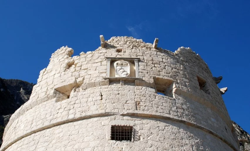
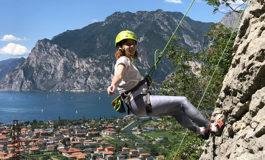
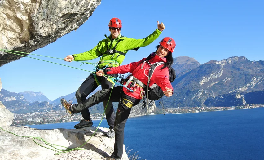
Pass by Bastione and Capanna Santa Barbara to reach the beginning of the Via Ferrata. As you ascend the wall of Rocchetta you can see the roofs of Riva del Garda and the blue waters of Lake Garda beneath your feet. Although the long series of ladders, slightly overhanging in places, are not technically demanding, they do require determination and you must not suffer from a fear of heights.

After 1200 m of ascent, the view from Cima Sat extends from south to north, from the basin of Lake Garda to the entire Sarca Valley.

Further information and useful links

Facing a via ferrata requires knowledge of the right technique of progression and some training. If you want to try out this experience for the first time or check the use of the via ferrata set, we recommend that you contact one of our mountain guides: Guides – Via ferratas with the experts 

For further information on routes, activities, events and accommodation at lake Garda: Garda Trentino - +39 0464 554444


Route info
Intermediate
Route number
Distance
4,0 km
Duration
4 h 00 min
Altitude difference (+)
1.192 m
Altitude difference (-)
46 m
Physical effort
Scenary
Highest point
1.231 m
Lowest point
85 m
Suggestions

"Endless ladders lead to one of the most panoramic peak of northern Lake Garda" (from the website via-ferrata.de). 

Safety guidelines

Safety Tips

  1. Only do the via ferrata if you are reasonably fit and in excellent health.
  2. Do not do the via ferrata in bad weather, especially if it looks like a storm is coming.
  3. Do not do the via ferrata alone: if you have an accident nobody will be able to call for help.
  4. The risk of rock falls increases if there are others on the via ferrata or with wind or rain.
  5. Always check route conditions; in winter you may find snow and ice.
  6. Use proper safety gear (helmet, harness, ferrata kit with double self-locking carabiners and energy absorbing systems). Put on your helmet once you get near to the wall in case of rock falls.
  7. During progression always keep both carabiners clipped onto the safety cable and when you pass the anchor points make sure at least one carabiner is clipped on to each safety cable.
  8. Only one person may be on any length of cable between two anchor points.
  9. Wear clothing and hiking boots suited to the altitude, the season and the length of the route and ferrata gloves.
  10. Pay special attention on the easy parts, where there are no cables.
  11. Always check the condition of the bolts and cables on the wall as they can suffer damage in bad weather.
  12. Carefully evaluate the crowding conditions and the state of preservation of the safety gear on the via ferrata. Beware, YOU are ultimately and solely responsible for undertaking a via ferrata safely and responsibly.

Emergency telephone number 112.


The information on this chart is subject to inevitable variations, so this means that none of the indications are absolute. It is not entirely possible to avoid giving inexact or imprecise information, given how quickly environmental and weather conditions can change. For this reason, we decline any responsibility for changes which the user may encounter. In any case, the hiker is advised to check the conditions of the places, environment and weather before setting out.

Punto di partenza
Riva del Garda
Directions

Access

From Riva del Garda head up along the SAT404 trail until the mountain hut Capanna Santa Barbara, then continue along the SAT404B trail.

Route

After the first easy bolted slabs you come to the foot of a wall which you ascendby means of a 40 metres ladder (1). At the other end, you proceed on rockyoutcrops until you come to a big rock wall. A first ladder 15 metres long (2) takesyou to the 70 metres ladder (3). Finally, a short ladder of just 15 metres (4) takesyou into the woods and from there, a trail takes you to the rocky ridge boltedwith cables and ladders (5) which takes you to the summit of Cima SAT.

Return

There are two options:

• from the summit head down the other side along a bolted section until the fork in the trail, where you take the right-hand path, Sentiero dei Crazidei (SAT418), and then the SAT402 which descends to Riva del Garda.

• descend the bolted section as far as the fork and then head left over ledges bolted with metal cables on SAT413, leaving the trail for Bochet de Concolì on your right. Follow the trail SAT404 and reach, thanks to a short ladder (6) first the chapel of Santa Barbara, the mountain hut of the same name and then Riva del Garda.

public transportation

The main towns in Garda Trentino - Riva del Garda, Arco, Torbole sul Garda, Nago – are connected by several urban and intercity bus lines which will take you to the starting point of tours or in the immediate surroundings.

You can also get to Riva del Garda and Torbole sul Garda by the public ferry service.

Up-to-date information on timetables and routes.


How to get there

A22 motorway, exit: Rovereto Sud - Lake Garda. Then SS240 in the direction of Riva del Garda.

Find out how to reach Garda Trentino.


Where to park

Parking near the former hospital (Via Rosmini) or the former cemetery (Viale Damiano Chiesa).

Paid parking: Terme Romane (Viale Roma), Vecchia stazione (Largo Medaglie d’Oro), Ex-agraria (Via Lutti), Area ex-Cattoi (Viale Rovereto).

You need to wear the right clothing and take the proper gear when you go hiking in the mountains. Even on relatively short easy outings make sure to take all you need so you don't run into trouble if things take an unexpected turn, for example a storm blows up or you have a sudden drop in energy levels.

What should you absolutely have with you on a via ferrata tour?

  • rucksack (25/30L capacity) for a day trip
  • technical mountain clothing  
  • hiking boots with Vibram or similar sole  
  • via ferrata gear  
  • harness  
  • helmet  
  • gloves  
  • pickaxe and crampons (when necessary)  
  • a length of rope (recommended)
Riva del Garda
Bastione scenic lift
open
closed
culture
Riva del Garda
Bastione
always open
fortification
Arco
Free Alp - Mountain Guide Service
open
closed
climbing guide
Arco
Arco Mountain Guide
open
closed
climbing guide
Arco
MMove into Nature
hiking guide
Riva del Garda
LOLgarda
open
closed
hiking guide
Ledro
Trentino Climb
open
closed
climbing guide
Arco
Mountime - Outdoor Adventures
open
closed
climbing guide
Torbole sul Garda - Nago
Canyon Adventures
open
closed
canyoning
You might be interested in
Discover related tours
Via ferrata Colodri | © Archivio Garda Trentino (ph. Watchsome), Garda Trentino
Intermediate
Arco
Via Ferrata Colodri - Colt
Distance 1,1 km
Duration 1 h 00 min
Altitude difference (+) 305 m
Altitude difference (-) 52 m
Status
closed
Via ferrata Rio Sallagoni | © Archivio Garda Trentino (ph. Watchsome), Garda Trentino
Intermediate
Dro & Drena
Via Ferrata Rio Sallagoni
Distance 2,3 km
Duration 2 h 00 min
Altitude difference (+) 192 m
Altitude difference (-) 192 m
Status
open
Via Ferrata "Che Guevara" | © Ralf Stute - www.via-ferrata.de, Garda Trentino
Difficult
Dro & Drena, Comano, Valle dei Laghi
Via Ferrata Che Guevara - Monte Casale
Distance 13,9 km
Duration 8 h 00 min
Altitude difference (+) 1.575 m
Altitude difference (-) 1.575 m
Status
closed
Via ferrata Rino Pisetta - Piccolo Dain | © Archivio Garda Trentino (ph. Tommaso Prugnola), Garda Trentino
Difficult
Valle dei Laghi
Via Ferrata Rino Pisetta - Dain Piccolo
Distance 6,1 km
Duration 5 h 00 min
Altitude difference (+) 899 m
Altitude difference (-) 898 m
Status
open
Via Ferrata Signora delle Acque | © Giampaolo Calzà ©APT Garda Trentino, Garda Trentino
Difficult
Comano
Via Ferrata Signora delle Acque - Rio Ruzza
Distance 5,2 km
Duration 3 h 00 min
Altitude difference (+) 298 m
Altitude difference (-) 299 m
Status
open
Bolted trails Scaloni / Cavre / Anglone | © G.P. Calzà, Garda Trentino
Easy
Dro & Drena
Bolted trail "degli Scaloni" - "delle Cavre" - "dell'Anglone"
Distance 7,6 km
Duration 4 h 00 min
Altitude difference (+) 486 m
Altitude difference (-) 485 m
Status
open