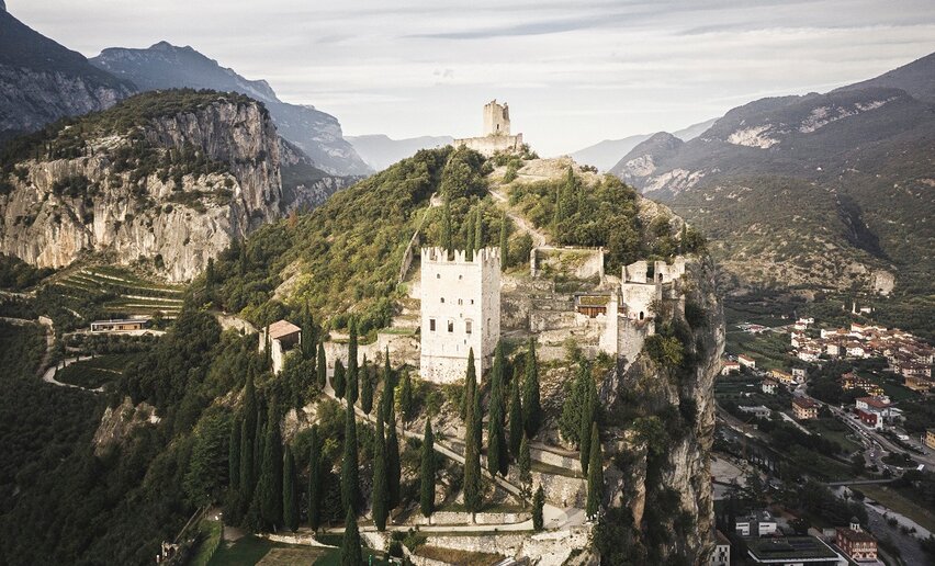
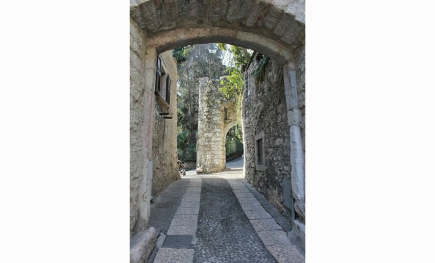
aria.quick_link.navi aria.quick_link.skiptomaincontent aria.quick_link.footer
Garda Trentino Logo
Top

The Dürer Promenade of Arco

Arco

Category
Difficulty
Easy
Duration
2:21
Duration in hours
Distance
7.6
Distance in km
Status
open
Suggested period
Jan
Feb
Mar
Apr
May
Jun
Jul
Aug
Sep
Oct
Nov
Dec

A walk from the center of Arco to Varignano, following in the footsteps of the painter Albrecht Dürer who, inspired by these places, painted the castle and the village at the end of the 15th century.

This itinerary follows the hypothetical route taken in 1495 by the Nuremberg painter Albrecht Dürer through the olive groves of Arco toward the places from which he painted his famous view of the town, which captures the castle surrounded by the village and olive trees. The watercolor "Venediger Klausen," now exhibited at the Louvre in Paris, captures with almost photographic quality the rocks of the cliff, the fortified village, and the silvery color of the olive leaves. The staging is, however, strongly idealized, compressing on a single canvas landscape elements and views that are quite distant from each other.

Dürer visited the town of Garda on his first trip to Italy (1494), which he undertook to closely learn about the artistic innovations introduced during the Renaissance. His destination was Venice, and from there he probably moved on to other centers in northern Italy, where he had the chance to observe works by the masters of the time, including Mantegna, Carpaccio, and the brothers Giovanni and Gentile Bellini.
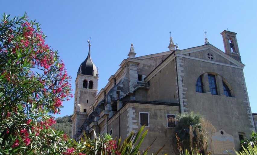
The path is accompanied by some texts of Italian writers of the time (Nicolò d’Arco, Jacopo Vargnano), which evoke the amazement with which the northern traveler observed for the first time a country with a Mediterranean landscape and atmosphere. 

Further information and useful links
You chose the perfect itinerary for your legs, now it’s time to tackle it at your best. Discover the trekking specialists: guides, companions, and local shops who can give you valuable tips and the right support for every step.
details
  • Scenic
  • Round trip
  • Refreshment stops available
  • Cultural/historical interest
Route info
Easy
Route number
Distance
7,6 km
Duration
2 h 21 min
Altitude difference (+)
212 m
Altitude difference (-)
212 m
Physical effort
Scenary
Highest point
236 m
Lowest point
79 m
Suggestions

Curiosity: In the shape of the painted cliff, you can recognize the profile of a human face. Can you spot it?

The view of Arco Castle appears in Dürer’s watercolor "Venediger Klausen," now kept at the Louvre. This "portrait" captures the rock of the cliff, the fortified town, and the silvery tone of the olive foliage with almost photographic detail. The composition is, however, idealized and brings together on a single canvas landscape elements and views that are actually quite distant from one another.

You might be interested in
Discover related tours
© Stefania Oradini, Garda Trentino
Easy
Ledro
Madonnina di Bezzecca
Distance 4,3 km
Duration 1 h 30 min
Altitude difference (+) 142 m
Altitude difference (-) 142 m
Status
open
© Fototeca Trentino Sviluppo foto di A. Russolo, Garda Trentino
Easy
Comano
Castel Restor and surroundings
Distance 5,1 km
Duration 2 h 00 min
Altitude difference (+) 148 m
Altitude difference (-) 151 m
Status
open
© ApT Rovereto Vallagarina Monte Baldo - Prodotto Outdoor, Garda Trentino
Easy
Surroundings, Val di Gresta
Walk to Malga Somator with kids
Distance 2,1 km
Duration 35 min
Altitude difference (+) 65 m
Altitude difference (-) 7 m
Status
open
Start of the Walnut Trail | © Fototeca Trentino Sviluppo foto di A. Russolo, Garda Trentino
Easy
Comano
The walnut trail
Distance 9,6 km
Duration 2 h 30 min
Altitude difference (+) 265 m
Altitude difference (-) 265 m
Status
open
© Natalia Pellegrini, Garda Trentino
Easy
Ledro
Walking around Lake Ledro
Distance 9,5 km
Duration 2 h 30 min
Altitude difference (+) 34 m
Altitude difference (-) 35 m
Status
open
view of Castel Spine | © Silvia Ricca, Trentino Sviluppo foto di B. Bolchi
Easy
Comano
Campo Lomaso, the Roman Bridge and Castel Spine
Distance 7,2 km
Duration 2 h 07 min
Altitude difference (+) 177 m
Altitude difference (-) 157 m
Status
open