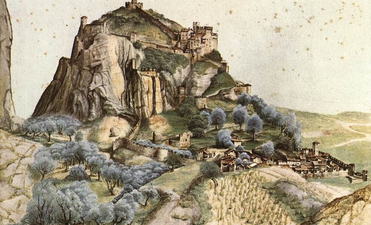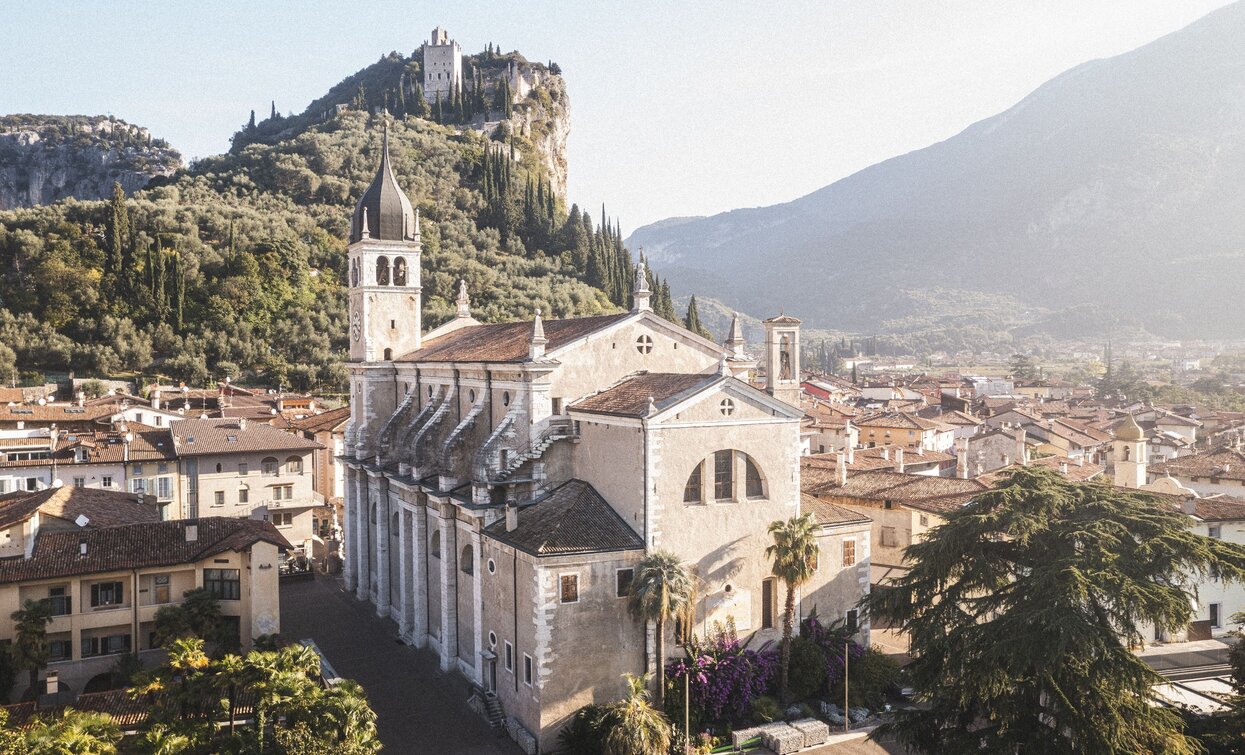
A walk from the centre of Arco to Varignano, in the footsteps of the painter Albrecht Dürer who at the end of the 15th century was inspired by these places to paint the castle and town.
This itinerary follows in the footsteps of the Nuremburg artist Albrecht Dürer through the olive groves of Arco to the point where he painted his famous view of the town, immortalising the castle surrounded by the medieval village and olive groves.
Dürer visited this town on Lake Garda on the way back from his first Italian journey (1494), which he embarked on in order to get to see the artistic innovations introduced during the Renaissance. His destination was Venice and he probably moved around from there to other towns in northern Italy where he could examine the works of masters of the period such as Mantegna, Carpaccio and the brothers Giovanni and Gentile Bellini.
The path is accompanied by some of the writings of Italian authors of the period (Nicolò d’Arco, Jacopo Vargnano), which give us an idea of the amazement felt by a traveller from the North looking for the first time on a country with a Mediterranean atmosphere and landscape.


Curious fact: in the rock of the cliff in the painting, the profile of a human face can be seen. Can you make it out?
The view of the castle of Arco appears in Dürer's watercolour “Venediger Klausen”, today housed in the Louvre. This “portrait” captures the rock of the cliff, the fortified town and the silvery hue of the foliage of the olive trees in quasi-photographic detail. The composition is an ideal one however, bringing together on a single canvas elements of the landscape and views which are actually quite far apart from one another.
The telephone number for the emergency services is 112.
The information on this chart is subject to inevitable variations, so this means that none of the indications are absolute. It is not entirely possible to avoid giving inexact or imprecise information, given how quickly environmental and weather conditions can change. For this reason we decline any responsibility for changes which the user may encounter. In any case, the hiker is advised to check the conditions of the places, environment and weather before setting out.
From Arco to the Dürer viewing point:
From piazza 3 Novembre take via Vergolano on the left; at the end of the road, turn right into via Monte Santo and follow directions for the Castle. Shortly after, at the intersection with via Dosso, turn left down via Stranfora until you pass through the gate of the same name in the direction of the Arboretum. Head uphill towards Laghel as far as the first stage of the Stations of the cross, then turn left and continue on for a few hundred metres along the road that passes through the olive grove. You pass some houses at the point where the road begins to climb and leave the road on the left to come to the panoramic position where it is presumed that Dürer painted the famous view.
To the foothills of Baone:
Go back onto the path and head straight in the direction of the Falesia Baone crag. Leaving the climbing area on your right, continue on straight on the main trail which runs through the olive grove until it comes out on the road for Padaro. Turn left and head down the road. Shortly after, to the right of the entrance to the Maso of the same name, you come to the “Olivo del Botes”, one of the most ancient olive trees in the area: it is in fact estimated to be between 800 and 1000 years old. Keep on downhill and you soon come to Varignano.
Madonna delle Grazie and return trip:
In Varignano head down via Vittorio Veneto for about 1 km. Shortly after the intersection with via San Giuseppe, at the point where the road bends to the left, continue on straight onto a secondary road. At the end of this road continue along the trail on the banks of the stream which leads to the car park of the Convent Madonna delle Grazie.
To get back to Arco , on foot or by bus, go down Via delle Grazie and continue towards the left, always keeping to the main road.
The main towns in Garda Trentino - Riva del Garda, Arco, Torbole sul Garda, Nago – are connected by several urban and intercity bus lines which will take you to the starting point of tours or in the immediate surroundings.
You can also get to Riva del Garda and Torbole sul Garda by the public ferry service.
A22 Motorway, exit: Rovereto Sud - Lake Garda. Then SS240 in the direction of Arco.
Parking in Caneve (5 minutes walk to the town centre).
Paid parking: Foro Boario, near the bridge (Via Caproni Maini) or the post office (Via Monache).
This excursion is quite simple and presents no particular difficulty. However, we still recommend you to wear suitable footwear, a hat, sun screen and sunglasses. And be sure to bring water!

