Logo Garda
Top

SUP TOUR: 4. Conca d'Oro

Torbole sul Garda - Nago, Riva del Garda
Category
Difficulty
Intermediate
Duration
1:30
Duration in hours
Distance
4.9
Distance in km
Status
open
Suggested period
Jan
Feb
Mar
Apr
May
Jun
Jul
Aug
Sep
Oct
Nov
Dec

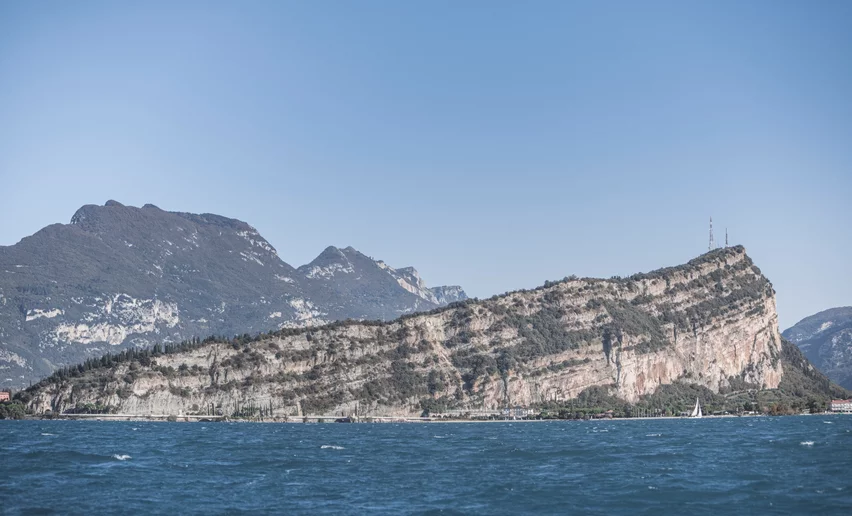
An intermediate level tour with marvellous views which follows the northern shore of Lake Garda as far as Torbole and allows you to apreciate the beauty of the lake shore close up

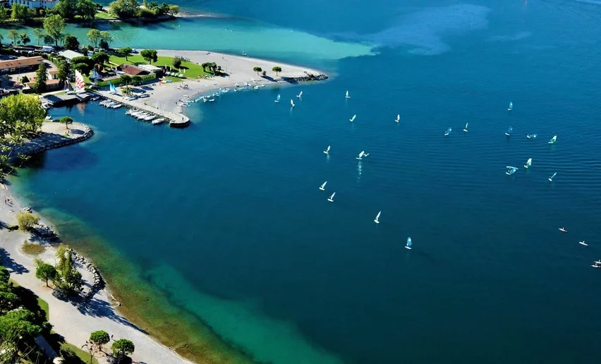
A tour which winds along the lake front, following the northern shore of Lake Garda from Riva to Torbole. Just a few kilometres long but offering you a chance to appreciate all the riches the lake has to offer: a training area for divers, the rocky slopes of Mount Brione, the mouth of the RIver Sarca with its reed beds and finally, a nice beach where you can take a break in the sunshine.

While you are out on the water, if you look closely you will see what is called the water line: the point where the currents of the River Sarca meet those of the lake, with little ripples and a clear difference in the colour of the lake and river water.

Watch out! If you decide to go out on the water in the morning, keep an eye on the conditions of the wind known as the "Pelèr" which blows in the early part of the day. Always check the weather forecast.

Further information and useful links

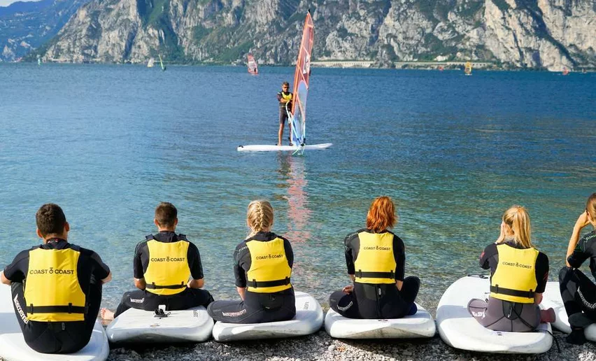
For further information about sports friendly accommodation, contact details for SUP hire, guides and useful information: Garda Trentino - +39 0464 554444

This tour was recommended by SUP Club Riva del Garda.


Route info
Intermediate
Route number
Distance
4,9 km
Duration
1 h 30 min
Altitude difference (+)
0 m
Altitude difference (-)
0 m
Technical skills
Physical effort
Scenary
Highest point
62 m
Lowest point
62 m
Suggestions

The mouth of the River Sarca is home to many ducks and swans which will come looking for food.

Safety guidelines

Safety Tips 

  1. Inform yourself about wind, water, and weather conditions. In a short time, the wind can change, the swell can increase, and it can start to rain, even with thunderstorms. For this reason, it is important be able to swim even in rough water.
  2. Inform yourself about local regulations. When in doubt, ask for the advice of specialised guides and local people.
  3. In case of solo trips, inform someone about your planned itinerary and departure time.
  4. Only use boats and gear appropriate to your abilities and wear a CE certified lifejacket.
  5. Maintain the safety distance from public transportation crafts, respect right of way rules and do not cross the course of motorboats to avoid accidents and fines.
  6. When stand up paddling, always attach your leash, never leave your board, and keep a distance of 500 m from the shore and cliffs from which rocks could break off.

The information on this chart is subject to inevitable variations, so this means that none of the indications are absolute. It is not entirely possible to avoid giving inexact or imprecise information, given how quickly environmental and weather conditions can change. For this reason we decline any responsibility for changes which the user may encounter. In any case,  the hiker is advised to check the conditions of the places, environment and weather before setting out.

Punto di partenza
Porfina Beach - Riva del Garda
Directions

The starting point is Purfina di Riva del Garda, where you can enter the water by means of a slipway; now head in the direction of Torbole, paddling just a few metres from the sheer cliffs before the harbour of San Nicolò. Here you will pass a famous scuba diving training ground, famous for the metal statue of  "Silent Christ", moe than 3 metres tall and situated at a depth of 15 metres. The training ground is protected from boats by an effective system of buoys marking the perimeter. A little further ahead, you come to the slopes of Mount Brione, nature reserve: if you look closely, you may see some of the many nests of waterbirds.

Once you get to the marvellous blue bay, always busy with surfers of every age, continue on across the mouth of the River Sarca in the municipality of Torbole where a small stretch of reed beds remains which still shows how the lake front originally looked.

Continue on, admiring the busy beach of Torbole, paddling in front of Pavese Park, until you come to the area called Conca d'Oro, right beside the impressive Adige-Garda tunnel. The beach was actually built using the rubble which came from the excavation of the tunnel through which the River Adige flows into the lake and is open in periods of flood in order to allow water to drain away. The beach is the perfect place to catch your breath before heading back again, cutting across the lake to the point where you started from.

public transportation

The main towns in Garda Trentino - Riva del Garda, Arco, Torbole sul Garda, Nago – are connected by several urban and intercity bus lines which will take you to the starting point of tours or in the immediate surroundings.

You can also get to Riva del Garda and Torbole sul Garda by the public ferry service.

Up-to-date information on timetables and routes.


How to get there

A22 motorway, exit: Rovereto Sud - Lake Garda. Then follow SS240 in the direction of Riva del Garda. 

Find out how to reach Garda Trentino.


Where to park

Parking near the former hospital (Via Rosmini) or the former cemetery (Viale Damiano Chiesa).

Paid parking: Terme Romane (Viale Roma), Vecchia stazione (Largo Medaglie d’Oro), Ex-agraria (Via Lutti), Area ex-Cattoi (Viale Rovereto).

In spring and summer you are advised to wear a semi-drysuit, in summer all you need is a swimsuit and lycra suit. You always need to wear a life jacket. 

Riva del Garda
Riserva Naturale Monte Brione
nature
Torbole sul Garda - Nago
Casa del Dazio
culture
Riva del Garda
Sailing Du Lac
open
closed
water sport
Torbole sul Garda - Nago
Surf Segnana Torbole
open
closed
windsurf
Torbole sul Garda - Nago
Vasco Renna windsurfcenter
open
closed
windsurf
Riva del Garda
Pier Watersports Center
open
closed
windsurf
You might be interested in
Discover related tours
SUP in the waters of Riva del Garda | © Archivio Garda Trentino (ph. Watchsome), Garda Trentino
Intermediate
Riva del Garda
SUP TOUR: 8. Sperone
Distance 5,0 km
Duration 35 min
Altitude difference (+) 0 m
Altitude difference (-) 0 m
Status
open
SUP in the waters of Riva del Garda | © Archivio Garda Trentino (ph. Watchsome), Garda Trentino
Intermediate
Riva del Garda
SUP TOUR: 5. Ca' Rossa
Distance 3,5 km
Duration 45 min
Altitude difference (+) 0 m
Altitude difference (-) 0 m
Status
open
View from Monte Brione (Doss Casina and Monte Altissimo) | © Archivio Garda Trentino (ph. Vuilleumier) , North Lake Garda Trentino
Easy
Torbole sul Garda - Nago, Riva del Garda
SUP TOUR: 1. Baia Azzurra Tour
Distance 2,4 km
Duration 30 min
Altitude difference (+) 0 m
Altitude difference (-) 0 m
Status
open
Around Lake Ledro by SUP | © Archivio Garda Trentino (ph. Watchsome), Garda Trentino
Intermediate
Ledro
SUP TOUR: 7. Lago di Ledro
Distance 8,3 km
Duration 2 h 30 min
Altitude difference (+) 0 m
Altitude difference (-) 0 m
Status
open
The cycle path along the lake shore in Torbole | © Archivio APT Garda Trentino (ph. Vuilleumier) , North Lake Garda Trentino
Difficult
Torbole sul Garda - Nago, Riva del Garda
SUP TOUR: 9. Corno di Bò
Distance 7,4 km
Duration 2 h 00 min
Altitude difference (+) 2 m
Altitude difference (-) 2 m
Status
open
SUP in the waters of Riva del Garda | © Archivio Garda Trentino (ph. Watchsome), Garda Trentino
Difficult
Riva del Garda, Torbole sul Garda - Nago
SUP TOUR: 10. Coast to Coast
Distance 7,5 km
Duration 2 h 00 min
Altitude difference (+) 0 m
Altitude difference (-) 0 m
Status
open