aria.quick_link.navi aria.quick_link.skiptomaincontent aria.quick_link.footer
Garda Trentino Logo
Top

Garda Trek - Top Loop 1: from Riva del Garda to Rifugio Pernici

Riva del Garda, Ledro

Category
Difficulty
Difficult
Duration
7:00
Duration in hours
Distance
13.7
Distance in km
Status
open
Suggested period
Jan
Feb
Mar
Apr
May
Jun
Jul
Aug
Sep
Oct
Nov
Dec

This stage counts nearly 1600 metres of elevation gain, from the mediterranean shores of Lake Garda to the alpine peaks between Garda Trentino and Valle di Ledro. 

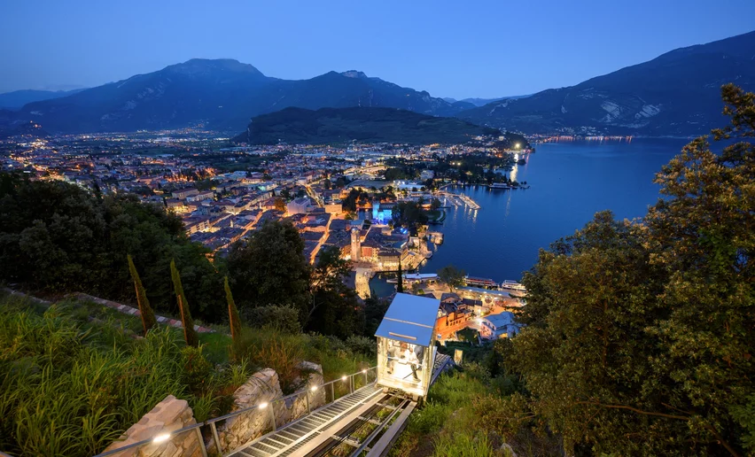
The first stage of Garda Treks takes you from the Mediterranean ambience of the centre of Riva del Garda to the alpine environment of the ridges which lead you one step after another to the mountain hut Rifugio Pernici.

This trail starts out with a very tough stretch, gaining altitude fast as you head up the steep slopes of Monte Rocchetta on the trail SAT 418. The elevation gain is approx. 1550 m, but it's well worth the effort as you enjoy the fabulous views on both sides once you get to the ridge. 

Please note that along the route there is nowhere to stop off for refreshments. So make sure to bring plenty of water and snacks.

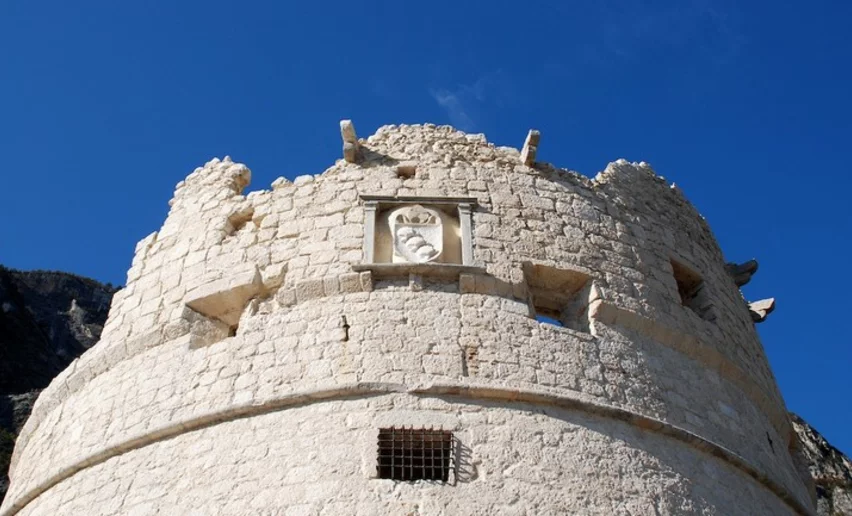
In the vicinity of Rifugio Pernici you can find a number of trenches dating back to the First World War. This was in fact part of the Austrian defence line. The building which today hosts the hut was built during that period as an officers' cantine.

Further information and useful links
You’ve picked the perfect trail – now make sure you’re ready to enjoy it to the fullest. Local hiking specialists are here to help: guides, shops and experts with the tips and support you need for every step of the way.
details
  • Multi-stage route
  • Scenic
  • Summit route
Route info
Difficult
Route number
Distance
13,7 km
Duration
7 h 00 min
Altitude difference (+)
1.822 m
Altitude difference (-)
317 m
Physical effort
Scenary
Highest point
1.794 m
Lowest point
88 m
Suggestions

At the Pernici hut you must absolutely taste the potato polenta: a substantial dish ideal for recovering strength after hiking.

If you want to head back down to Riva del Garda after sleeping over in the hut we recommend this route: Trail SAT 402, the “pinza” trail: outside the hut take SAT 402 which leads down to Riva del Garda. The trail passes through Campi and then joins the old “pinza” road, one of the ancient communication routes in Garda Trentino. Near Riva del Garda, the trails passes by the ruins of San Giovanni and the chapel of Santa Maria Maddalena; when you come to the junction with SAT 404 you can choose to continue on in the direction of Bastione to enjoy the marvellous view of the lake or else head straight down to the town centre.

You might be interested in
Discover related tours
On the top of Monte Stivo | © G.P. Calzà ©APT Garda Trentino , Garda Trentino
Difficult
Dro & Drena, Arco
GardaTrek - Top Loop 4: to the balcony over Lake Garda
Distance 16,3 km
Duration 7 h 50 min
Altitude difference (+) 1.917 m
Altitude difference (-) 16 m
Status
open
View from the summit of Biaina on Lake Garda / Garda Trentino | © G.P. Calzà, North Lake Garda Trentino
Difficult
Dro & Drena, Arco, Tenno
GardaTrek - Top Loop 3: a long descent to the River Sarca
Distance 20,3 km
Duration 7 h 55 min
Altitude difference (+) 1.000 m
Altitude difference (-) 2.000 m
Status
open
View of the Malga Grassi | © Alessandro de Guelmi, Garda Trentino
Intermediate
Riva del Garda, Tenno
GardaTrek - TopLoop 2: descent to Lake Tenno (Alternative route)
Distance 12,3 km
Duration 4 h 30 min
Altitude difference (+) 590 m
Altitude difference (-) 1.215 m
Status
closed
View on lake Garda from the trail | © Archivio APT Garda Trentino (ph. Calzà) , Garda Trentino
Difficult
Dro & Drena, Torbole sul Garda - Nago, Surroundings, Arco, Ledro, Riva del Garda, Tenno
Garda Trek - Top Loop: The crown of Garda Trentino
Distance 93,3 km
Duration 47 h 00 min
Altitude difference (+) 7.266 m
Altitude difference (-) 5.601 m
Status
partially open
On Mount Baldo | © Archivio Garda Trentino - Ph. G. P. Calzà, North Lake Garda Trentino
Intermediate
Surroundings, Torbole sul Garda - Nago
GardaTrek - Top Loop 7: Back to the water
Distance 7,6 km
Duration 2 h 50 min
Altitude difference (+) 345 m
Altitude difference (-) 655 m
Status
open
View from Monte Altissimo | © Archivio Garda Trentino (ph. Watchsome), Garda Trentino
Difficult
Surroundings, Torbole sul Garda - Nago
GardaTrek - Top Loop 6: In the Garden of Europe
Distance 11,3 km
Duration 7 h 00 min
Altitude difference (+) 1.839 m
Altitude difference (-) 0 m
Status
partially open