aria.quick_link.navi aria.quick_link.skiptomaincontent aria.quick_link.footer
Garda Trentino Logo
Top

Along the equipped trail "del Berghem" to San Martino and Malga Grassi

Riva del Garda

Category
Difficulty
Intermediate
Duration
6:30
Duration in hours
Distance
17.3
Distance in km
Status
open
WSEN
Suggested period
Jan
Feb
Mar
Apr
May
Jun
Jul
Aug
Sep
Oct
Nov
Dec

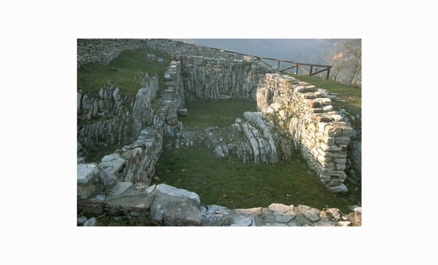
An interesting hike, connecting Riva del Garda to the archaeological site of San Martino. The circular route allows you to continue to Capanna Grassi for the lunch and then return to Riva along the other mountain side 

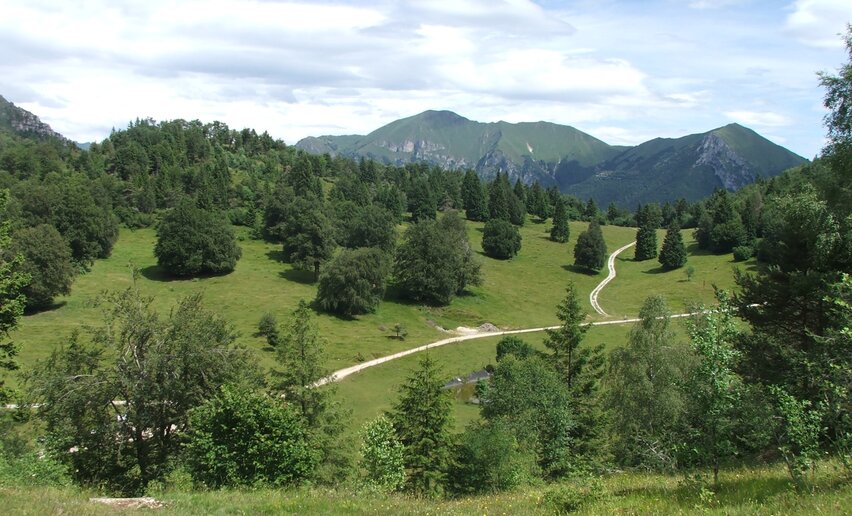
The trail,which climbs the slopes of Rocchetta and Monte Tombio, heads up the valley of the Gamella stream,  a little known but spectacular area of Garda Trentino, rich in hidden waterfalls. 

It has small sections fitted with metal cables and steps; this is the reason why it is graded EE and should only be used by experienced hikers.

After the visit of the archaological area of San Martino, continue to Malga Grassi and stop off at Capanna Grassi, well known for the tasty local food. To return follow the "sentiero della pinza", which follow the other side of the valley leading you down to Riva del Garda. 

To shorten the walk, take the path SAT402 in Campi to go back. 

Further information and useful links

For more information on routes, services (guides, mountain huts, shops etc.) and hiking friendly accommodation: Garda Trentino - +39 0464 554444

details
  • Scenic
  • Geological highlights
  • Round trip
  • Refreshment stops available
  • Cultural/historical interest
  • Flora
  • Secured passages
Route info
Intermediate
Route number
Distance
17,3 km
Duration
6 h 30 min
Altitude difference (+)
1.111 m
Altitude difference (-)
1.110 m
Physical effort
Scenary
Highest point
1.158 m
Lowest point
117 m
Suggestions

The archeological site San Martino, is one of the most important and significant of Garda Trentino. 

You might be interested in
Discover related tours
© Stefania Oradini, Garda Trentino
Difficult
Comano, Tenno, Riva del Garda, Ledro
Giro delle cime - Half tour
Distance 17,5 km
Duration 8 h 00 min
Altitude difference (+) 1.200 m
Altitude difference (-) 1.200 m
Status
open
Ponale | © Archivio APT Garda Dolomiti - Watchsome, Garda Trentino
Easy
Riva del Garda, Ledro
Ponale Path (from Riva del Garda)
Distance 6,4 km
Duration 3 h 00 min
Altitude difference (+) 736 m
Altitude difference (-) 272 m
Status
open
Reaching the Pernici Hut | © Stefania Oradini, North Lake Garda Trentino
Intermediate
Riva del Garda
Great War: from Malga Grassi to Rifugio Pernici
Distance 2,5 km
Duration 2 h 08 min
Altitude difference (+) 558 m
Altitude difference (-) 3 m
Status
open
view from the top of Biaena over the lower Vallagarina | © ApT Rovereto Vallagarina Monte Baldo - Prodotto Outdoor, Garda Trentino
Easy
Val di Gresta
From Passo Bordala to Monte Biaena
Distance 3,7 km
Duration 1 h 40 min
Altitude difference (+) 353 m
Altitude difference (-) 9 m
Status
open
© Staff Outdoor Garda Trentino AC, Garda Trentino
Intermediate
Ledro
Walking tour of the mountain huts of Val di Concei
Distance 14,6 km
Duration 7 h 00 min
Altitude difference (+) 1.035 m
Altitude difference (-) 1.035 m
Status
open
View over Lake Toblino and the Valle dei Laghi | © Archivio APT Garda Trentino (ph. R. Kiaulehn), North Lake Garda Trentino
Intermediate
Valle dei Laghi
Monte Gazza: view of the 4 lakes
Distance 13,0 km
Duration 7 h 00 min
Altitude difference (+) 900 m
Altitude difference (-) 900 m
Status
open