Garda Trentino Logo
Top

Coste di Baone

Arco

Category
Difficulty
Easy
Duration
2:00
Duration in hours
Distance
4.9
Distance in km
Status
open
WSEN
Suggested period
Jan
Feb
Mar
Apr
May
Jun
Jul
Aug
Sep
Oct
Nov
Dec

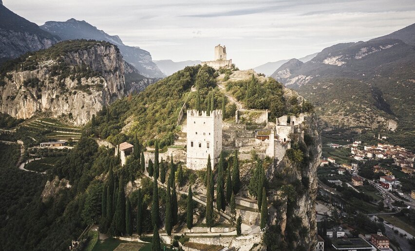
With its rocky slope and hillsides covered in olive groves Monte Baone is a landmark of Garda Trentino. From here there is an absolutely spectacular view over the entire  area.

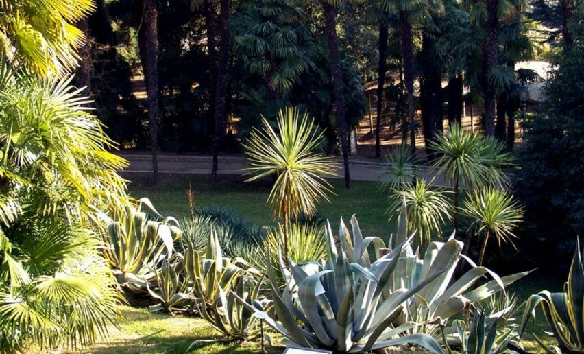
Arco has an extraordnary microclimate with agave and prickly pear thriving on limestone slabs, so that on crisp winter days there is a unique blend of Mediterranean vegetation against snow-capped Monte Baldo and the sunshine shimmering on the waters of Lake Garda.

The olive groves are an essential part of the Garda Trentino landscape and this trail is easy and suited to families with children who can have fun watching all the climbers in action on the Placche di Baone crag.

There is a fabulous view over the entire Garda Trentino area from Rochetta to Monte Baldo, stretching across the glittering waters of Lake Garda.

An easy trail suited to all, this is however a hiking trail and it requires the ability to walk on rough terrain. Some stretches run along the upper perimeter of the slabs so be careful to stay on the path

Further information and useful links

For more information on routes, services (guides, mountain huts, shops etc.) and hiking friendly accommodation: Garda Trentino - +39 0464 554444 

Route info
Easy
Route number
Distance
4,9 km
Duration
2 h 00 min
Altitude difference (+)
230 m
Altitude difference (-)
214 m
Physical effort
Scenary
Highest point
280 m
Lowest point
118 m
Suggestions

After the hike, walk up to the Castle of Arco for a visit through its walls.

You might be interested in
Discover related tours
© Staff Outdoor Garda Trentino AC, Garda Trentino
Intermediate
Ledro
Bocca de l'Ussol
Distance 9,1 km
Duration 4 h 30 min
Altitude difference (+) 889 m
Altitude difference (-) 890 m
Status
open
Between Tofino and Roda | © Alessandro de Guelmi, Garda Trentino
Difficult
Ledro, Tenno, Comano, Riva del Garda
Ledro Alps Trek Alpiedi - Leg 4: from Rifugio Pernici to Bivacco Campel
Distance 18,2 km
Duration 8 h 00 min
Altitude difference (+) 1.653 m
Altitude difference (-) 1.551 m
Status
open
Archeological Area San Martino (Riva del Garda loc. Campi) | © Marco Meiche, Garda Trentino
Easy
Riva del Garda
The Archaeological Area San Martino in Campi
Distance 2,3 km
Duration 1 h 05 min
Altitude difference (+) 140 m
Altitude difference (-) 125 m
Status
open
© Stefania Oradini, Garda Trentino
Difficult
Comano, Tenno, Riva del Garda, Ledro
Giro delle cime - Half tour
Distance 17,5 km
Duration 8 h 00 min
Altitude difference (+) 1.200 m
Altitude difference (-) 1.200 m
Status
open
© Staff Outdoor Garda Trentino AC, Garda Trentino
Intermediate
Ledro
Walking tour of the mountain huts of Val di Concei
Distance 14,6 km
Duration 7 h 00 min
Altitude difference (+) 1.035 m
Altitude difference (-) 1.035 m
Status
open
© Natalia Pellegrini, Garda Trentino
Difficult
Ledro
Ledro Alps Trek Alpiedi - Leg 1: from Storo to Tremalzo
Distance 27,8 km
Duration 10 h 00 min
Altitude difference (+) 2.469 m
Altitude difference (-) 1.186 m
Status
open