aria.quick_link.navi aria.quick_link.skiptomaincontent aria.quick_link.footer
Garda Trentino Logo
Top

Bastione and Santa Barbara, the lords of Riva del Garda

Riva del Garda

Category
Difficulty
Intermediate
Duration
1:45
Duration in hours
Distance
2.8
Distance in km
Status
open
WSEN
Suggested period
Jan
Feb
Mar
Apr
May
Jun
Jul
Aug
Sep
Oct
Nov
Dec

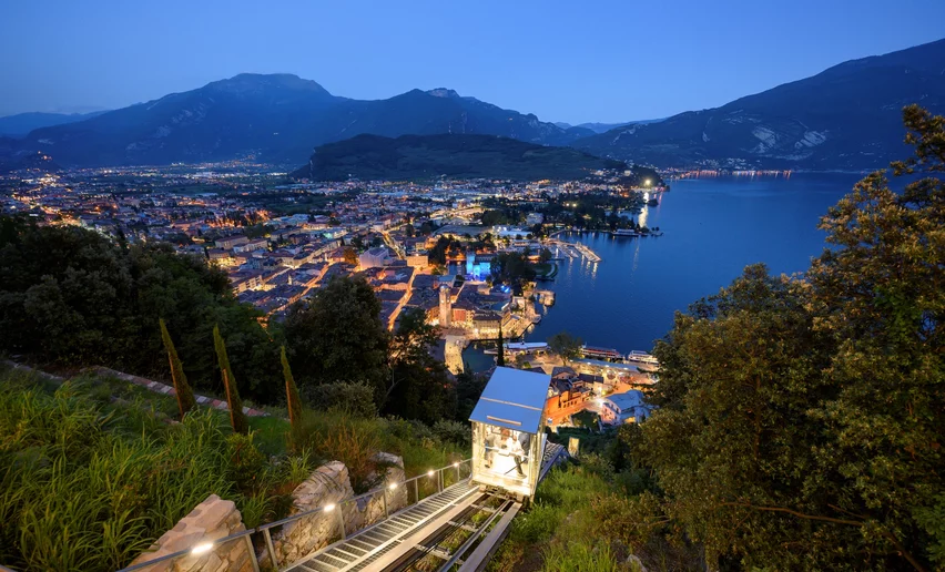
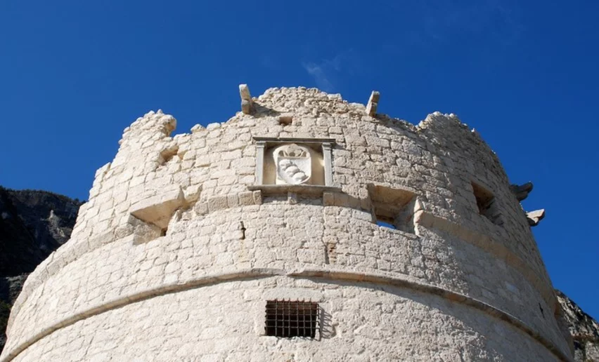
From Riva del Garda to Bastione and then on up to Santa Barbara: this hike touches on two of the symbols of the town perched on the mountainside above Riva del Garda


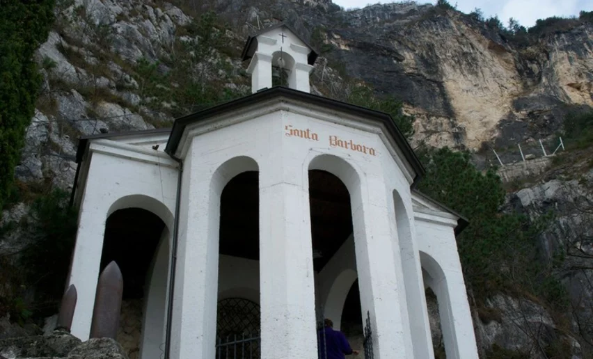
From down below, the Bastione and especially the chapel of Santa Barbara, seem incredibly far away, perched on the steep mountainside. However it doesn't take long at all to get to them and from up there you have spectacular views over Riva del Garda and the lake.

The chapel of Santa Barbara, standing out white against the rock of the mountain, was built during the 1920s when work was under way on the pipes carrying the water from Lake Ledro to the hydroelectric station in Riva del Garda and is dedicated to the patron saint of miners.

Further information and useful links

For more information on routes, services (guides, mountain huts, shops etc.) and hiking friendly accommodation: Garda Trentino - +39 0464 554444


details
  • Linear route
  • Scenic
  • Insider tip
  • Refreshment stops available
  • Cultural/historical interest
Route info
Intermediate
Route number
Distance
2,8 km
Duration
1 h 45 min
Altitude difference (+)
590 m
Altitude difference (-)
60 m
Physical effort
Scenary
Highest point
632 m
Lowest point
88 m
Suggestions

Santa Barbara is one of the most spectacular viewing points in Garda Trentino: don't forget your camera! 

You might be interested in
Discover related tours
© Archivio APT Garda Dolomiti - E. Biagi, Garda Trentino
Intermediate
Arco
Belvedere Pezol
Distance 7,0 km
Duration 3 h 20 min
Altitude difference (+) 612 m
Altitude difference (-) 614 m
Status
open
Meadows of Ca' de Mez | © Archivio Garda Trentino, Garda Trentino
Intermediate
Ledro
Malga Giù - San Martino
Distance 13,3 km
Duration 5 h 00 min
Altitude difference (+) 700 m
Altitude difference (-) 700 m
Status
open
Lake Toblino | © Armin Huber, Garda Trentino
Easy
Valle dei Laghi
Nosiola Trail 1
Distance 12,1 km
Duration 3 h 00 min
Altitude difference (+) 140 m
Altitude difference (-) 146 m
Status
open
© fototeca trentino sviluppo foto di b. bolchi, Garda Trentino
Intermediate
Comano
Monte San Martino nel Lomaso (da Lundo)
Distance 5,8 km
Duration 2 h 30 min
Altitude difference (+) 320 m
Altitude difference (-) 323 m
Status
open
View over lake Garda from the trenches of Monte Corno | © Associazione 1 Territorio 2 Fronti, Garda Trentino
Easy
Torbole sul Garda - Nago
WWI: Monte Corno and Busa dei Capitani
Distance 3,4 km
Duration 1 h 45 min
Altitude difference (+) 317 m
Altitude difference (-) 316 m
Status
open
Bunker from WWII - Dos Tenim (Nago - Torbole) | © Staff Outdoor GardaTrentino MM, Garda Trentino
Intermediate
Torbole sul Garda - Nago, Arco, Riva del Garda
The "Blue Line" of Garda Trentino
Distance 15,2 km
Duration 5 h 20 min
Altitude difference (+) 291 m
Altitude difference (-) 293 m
Status
open