Directions
The starting point given by the gps track is Arco, at the cycle path at the Caneve car park. Follow the cycle path towards the car park exit onto Viale Rovereto. Keep left here and continue on down the main road which you will leave on your right in just 100 m. Now turn onto the first road you come to on your right and keep on straight until you come to the church in the centre of Bolognano.
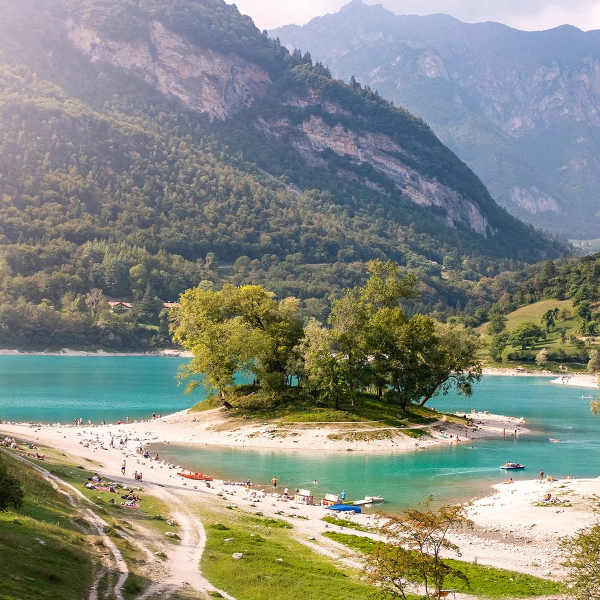
Leave the church on your left and follow directions for Gazzi where you begin to climb along the main road. About 300 m from the church, on a bend to the left, follow directions and take the secondary road right in front of you, Via del Cacciatore. Keep on straight, the road surface is still paved, but soon it will turn into a dirt track. Climbing steadily, follow the main trail until you come to a building which is clearly derelict, Malga Fiavei. Keep following the same road uphill and from here on the going gets rougher. After a few bends, follow directions and leave the road and keep right in the direction of Pannone. You have come to the top of the climb. After a short stretch of seemingly flat road, you start to go downhill on a rather steep road with some stretches of cement, some little steps, and the going at times quite rough. This downhill run takes you straight to Maso Naranch. The meadow in front of this farm building is a natural viewing terrace over Lake Garda and if there is any visibility at all you simply have to take some photos.
At the end of the meadow overlooking the lake you will find signposting for the route once more and now you head on down the trail. There are a number of turnoffs in the woods, all signposted. As you ride down the different stretches of trail you will cross the paved road for Nago several times. Always take care as you come out onto the road. It isn’t a very busy road, but you could come across other vehicles or bikes heading downhill. In this section of the trail too you will find some stretches are quite treacherous. In the vicinity of the village of San Tomè the trail is interrupted and now you have only to follow the steep paved road as far as Nago. When you come to the traffic lights at the intersection with the main road which leads down to Torbole and Arco, go straight through and head towards the right.
Riding through the streets of the historic centre of Nago you will come back onto the road you crossed at the intersection, this time at a roundabout. On your left you will see directions taking you down a steep lane which goes through a car park. If you opt to follow the route, after a short section on cement you will find yourself on a dirt track. In this first stretch the going is quite loose at times. You come to the main road now and, taking special care, cross it and take the cement road in front of you. This will take you downhill, alternating cement and dirt track, to the farmland of Pratosaiano. Follow directions at the various junctions, cross the fields and you will soon come to the outskirts of Arco. Pass the Fire Station and keep left at the roundabout, turn onto the cycle path and you will soon be back where you started from.

, Garda Trentino")

, North Lake Garda Trentino")
, North Lake Garda Trentino")
 , Garda Trentino")
, Garda Trentino")
, Garda Trentino")
, Garda Trentino")
, Garda Trentino")

, Garda Trentino")

, North Lake Garda Trentino")
, Garda Trentino")
, Garda Trentino")


 , Garda Trentino")