A panoramic tour that encompasses the entire Val di Gresta.
Signage: 1910. Val di Gresta Trail-Tour
This tour is fairly long and challenging due to the frequent gradient changes: the first part alternates slight ascents and downhill stretches, but soon the long ascent to Passo Bordala begins.

Have a taste of the local produce of Val di Gresta, known as the biological vegetable garden of Trentino and stop at Rifugio Somator to recharge your batteries.
ITRS - International Trail Rating System
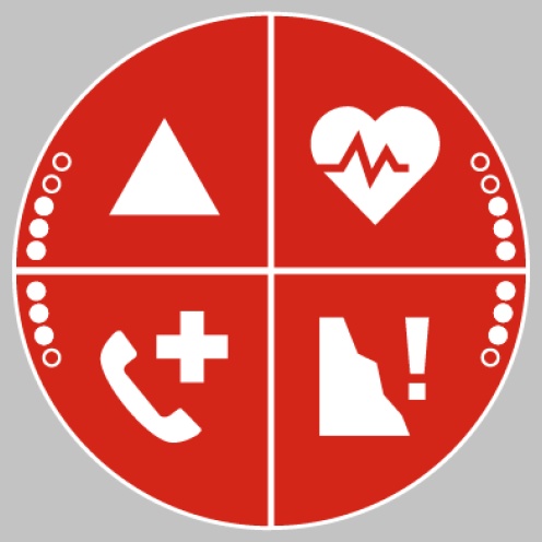
The ITRS is an objective way to assess trails and routes from a biker’s perspective, evaluating four aspects:
Discover more about the ITRS system and check the classification of this tour in the photo gallery.
Safety Tips
This information is subject to inevitable variations, so none of these indications are absolute. It is not entirely possible to avoid giving inexact or imprecise information, given how quickly environmental and weather conditions can change. For this reason, we decline any responsibility for changes which the user may encounter. In any case, it is advisable to check environment and weather conditions before setting out.
The route starts in Ronzo-Chienis and initially climbs towardsPasso Santa Barbara, a pass at 1169 m leading into the Valle delSarca. Here, there‘s also the chance to join one of the MTB trails coming up fromArco. A long descent follows, first on beautiful trails through the woods, then onnarrow secondary roads down to Valle San Felice, the lowest point of the tourat 550 m. Passing through the villages of Manzano and Nomesino, the routealmost entirely circles the ridge of Monte Biaena on paved roads, reaching PassoBordala after about 21 km and an additional 800 meters of elevation gain. Fromthere, you relaxingly descend on forest roads and trails towards Passo SantaBarbara, before heading back to the starting point along the same route.
Val di Gresta area can be reached from the other centres of Garda Trentino by extra-urban bus line 332 (Rovereto - Mori - Riva del Garda - Arco - Bolognano). Once you get off at the bus stop in Mori you can catch the bus that will take you to Ronzo-Chienis via the extra-urban line 310 (Rovereto - Mori - S. Felice - Ronzo Chienis).
Parking in Ronzo-Chienis.
Riding your bike requires specific clothing and equipment, even for relatively short and easy trips. It is always better to be prepared… e.g. for bad weather or a sudden drop in your energy levels. The unexpected things are part of the fun!
Remember to thoroughly evaluate the type of route you plan on doing, the locations you intend to cross and the current season. Has it been raining? Attention: The paths may be slippery and require more caution.
What do I need to bring on my bike tour?
It is always advised to let someone know where you plan to go and how long you expect to be.
Emergency telephone number 112.

