aria.quick_link.navi aria.quick_link.skiptomaincontent aria.quick_link.footer
Garda Trentino Logo
Top

Terlago Variant

Valle dei Laghi

Category
Difficulty
Intermediate
Duration
3:00
Duration in hours
Distance
21.3
Distance in km
Status
open
Suggested period
Jan
Feb
Mar
Apr
May
Jun
Jul
Aug
Sep
Oct
Nov
Dec

Separate circuit that starts and finishes in the village of Terlago.

Signage: 1710a. Variante Terlago

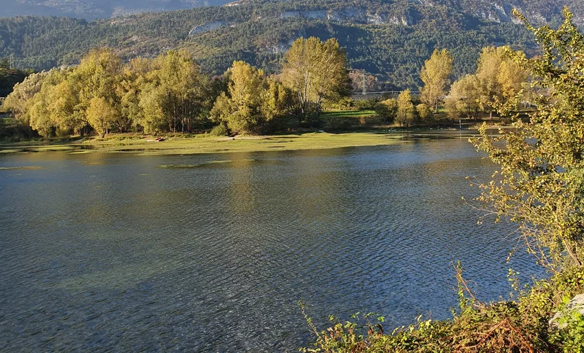
If the Valle dei Laghi Trail-Tour is too long for you, you can use these shortcuts to halve its length to just over 21 kilometres. The beautiful trails and idyllically situated Lago di Lamar can also be enjoyed on this circuit.

Further information and useful links
Picked your route? Now find the right experts to go with it. Make the most of every ride with support from local MTB specialists – from guides and rentals to shuttle services and workshops.
details
  • Cross-Country
  • Geological highlights
  • Insider tip
  • Round trip
  • Refreshment stops available
Route info
Intermediate
Route number
1710a
Distance
21,3 km
Duration
3 h 00 min
Altitude difference (+)
720 m
Altitude difference (-)
720 m
Physical effort
Scenary
Highest point
937 m
Lowest point
423 m
Suggestions

A short detour brings you to Lake Terlago, one of the two lakes in Trentino where you can try wakeboarding!

You might be interested in
Discover related tours
Ready for the descent! | © Archivio Garda Trentino (ph. Tommaso Prugnola), Garda Trentino
Easy
Tenno
“Per Elisa” Variant Trail
Distance 1,7 km
Duration 04 min
Altitude difference (+) 0 m
Altitude difference (-) 360 m
Status
open
Cycling through the streets of Canale | © Archivio Garda Trentino (ph. Tommaso Prugnola), Garda Trentino
Intermediate
Tenno
Vespana - Tour
Distance 20,6 km
Duration 3 h 05 min
Altitude difference (+) 730 m
Altitude difference (-) 730 m
Status
open
Ascent of Monte Brione | © Archivio Garda Trentino (ph. Tommaso Prugnola), Garda Trentino
Intermediate
Riva del Garda
Monte Brione Trail-Tour
Distance 6,2 km
Duration 50 min
Altitude difference (+) 240 m
Altitude difference (-) 240 m
Status
open
By bike through Rango | © Archivio Garda Trentino (ph. Tommaso Prugnola), Garda Trentino
Easy
Comano
Monte Guarda - Tour
Distance 21,5 km
Duration 3 h 00 min
Altitude difference (+) 770 m
Altitude difference (-) 770 m
Status
open
Bocca Caset ringing station | © Archivio Garda Trentino (ph. Tommaso Prugnola), Garda Trentino
Easy
Ledro
Variante Caset Rinalt - Trail
Distance 8,1 km
Duration 1 h 00 min
Altitude difference (+) 140 m
Altitude difference (-) 910 m
Status
open
Ascent to Tenno | © Archivio Garda Trentino (ph. Watchsome), Garda Trentino
Difficult
Tenno, Arco, Comano, Riva del Garda, Dro & Drena, Valle dei Laghi
Garda Dolomiti Tour
Distance 66,7 km
Duration 8 h 00 min
Altitude difference (+) 1.510 m
Altitude difference (-) 1.510 m
Status
open