Directions
The trail starts out on the lake front in Riva del Garda, in front of the Garda Trentino tourist information office. Take the cycle path which leads along Viale della Liberazione towards the centre of Riva. Pass the imposing structure of the Rocca and Piazza III Novembre, coming to the main road Gardesana Occidentale at the harbour. From here, follow the main road to the south for a few hundred metres. Before you reach the first tunnel on the Gardesana, keep to the right and take a steep cobbled ramp which leads to the start of the famous Ponale Trail. This stretch of the route, on a dirt road, has an incomparable panorama.
Without any alternative trail suitable for a bike we come to the end of the dirt road at the Ponale Alto Belvedere snack bar. At the nearby junction, keep right in the direction of Lake Ledro. Before the tunnel, turn left to cross the valley and the torrent avoiding the main road. Once on the road leading to Pregasina, go to the right and then, before the bridge, take the little road on your left. The trail to follow to get to Lake Ledro is clear. Cycle through Prè and Molina as far as the lake.
Following the road and subsequent road signs, cycle along the left side of the lake until you come to Pieve at the far end. Here you cross the main road and head towards the centre of the village. Signposting in the narrow streets leads you to the left where you take a short stretch of cycle path. This takes you to the start of the peaceful Val di Concei. Keep on straight along the main road, heading up the valley. Cycle through Locca, Enguiso and, when you get near Lenzumo, take the road on the right leading to Bocca di Trat and Rifugio Nino Pernici.
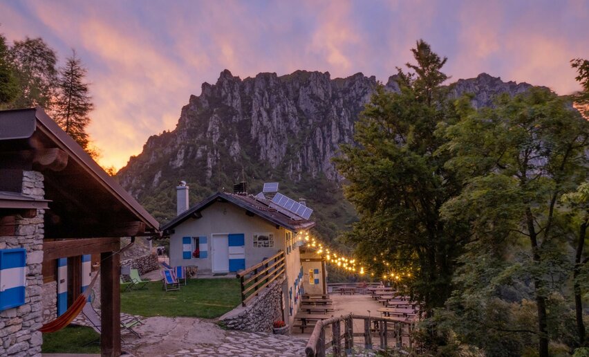
On this stretch, the signposting is very clear, and in any case, one thing is certain; it’s all uphill, and plenty of it. After a long stretch on the road, as you near your destination, the road turns into a dirt track. When you come to the pass, you will find the mountain hut Rifugio Nino Pernici on your right, a historic destination for local mountain bike enthusiasts.
As an alternative to shorten the tour, instead of continuing to Rifugio Pernici, we can take the 732a. Variante Dos de Preghent Trail along the asphalt road from Lenzumo to Malga Trat and return to Locca along this route. If we choose this option, the ride from Locca back to Riva follows the same route we took in the first part of tour, only in the opposite direction.
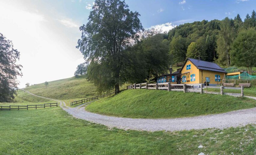
From Bocca di Trat, the direction for the descent is clear, so head down the other side, in what, in certain stretches, feels like a steep stream of rocks. Once you get to the meadows of Malga Pranzo, turn right towards the nearby mountain hut Capanna Grassi, another popular destination with local bikers.
With or without a break, it’s now time to cross the torrent and prepare for the descent, which has in store a wonderful surprise: the first trail designed from scratch and entirely built by the Garda Rangers to create a tailor-made experience for bikers. The trail is suitable for all experience levels thanks to a regular surface and a width of 1,20 m, but there are lots of curves to ensure a fun experience as well! Near Parisi, the trail meets the concrete road.
Once you have done the final stretch on cement, you pass in front of the church of San Rocco, continuing on to the start of the Pinza trail. From here on, you are on a dirt track once more, but it is stable and fairly easy. Mind your speed though because even though the trail is quite wide some stretches are very exposed. Take your time and enjoy the panorama on the last stretch which is almost entirely on cement. Your brakes will be red hot. At the end of the descent, you are practically at the entrance to the centre of Riva del Garda, your point of departure.

, Garda Trentino")
, Garda Trentino")

, North Lake Garda Trentino")
, North Lake Garda Trentino")
, Garda Trentino")
, North Lake Garda Trentino")
, Garda Trentino")
, Garda Trentino")
, North Lake Garda Trentino")
, Garda Trentino")
, Garda Trentino")
, Garda Trentino")
, Garda Trentino")
, North Lake Garda Trentino")
, Garda Trentino")
, Garda Trentino")
, Garda Trentino")
, Garda Trentino")


, Garda Trentino")
, North Lake Garda Trentino")
, Garda Trentino")
, Garda Trentino")

, Garda Trentino")


