Easy-going shortcut or family-friendly MTB tour.
Signage: 1720a. Cavedine - Tour Shortcut
Variant of the 1720. Cavedine - Tour. If you don’t necessarily want to do a lot of climbing but still want to enjoy a varied mountain bike tour, take the shortcut back to Sarche and enjoy the views over Lago di Cavedine.

The meadows and beaches along the shores of Lake Cavedine are perfect for a break.
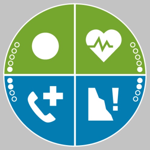
ITRS - International Trail Rating System
The ITRS is an objective way to assess trails and routes from a biker’s perspective, evaluating four aspects:
Discover more about the ITRS system and check the classification of this tour in the photo gallery.
Safety Tips
This information is subject to inevitable variations, so none of these indications are absolute. It is not entirely possible to avoid giving inexact or imprecise information, given how quickly environmental and weather conditions can change. For this reason, we decline any responsibility for changes which the user may encounter. In any case, it is advisable to check environment and weather conditions before setting out.
Hot to reach the start of the 1720. Cavedine - Tour:
Pietramurata, Sarche, the lakes of Toblino and Santa Massenza (bus stop Due Laghi) and Vezzano are connected by the intercity bus line 205 (Riva del Garda – Sarche – Trento to the other places in Garda Trentino.
Up-to-date information on timetables and routes.
Find out how to reach Garda Trentino.
Parking at the starting point of the 1720. Cavedine - Tour.
Riding your bike requires specific clothing and equipment, even for relatively short and easy trips. It is always better to be prepared… e.g. for bad weather or a sudden drop in your energy levels. The unexpected things are part of the fun!
Remember to thoroughly evaluate the type of route you plan on doing, the locations you intend to cross and the current season. Has it been raining? Attention: The paths may be slippery and require more caution.
What do I need to bring on my bike tour?
It is always advised to let someone know where you plan to go and how long you expect to be.
Emergency telephone number 112.

