aria.quick_link.navi aria.quick_link.skiptomaincontent aria.quick_link.footer
Garda Trentino Logo
Top

Variante Caset Rinalt - Trail

Ledro

Category
Difficulty
Easy
Duration
1:00
Duration in hours
Distance
8.1
Distance in km
Status
open
Suggested period
Jan
Feb
Mar
Apr
May
Jun
Jul
Aug
Sep
Oct
Nov
Dec

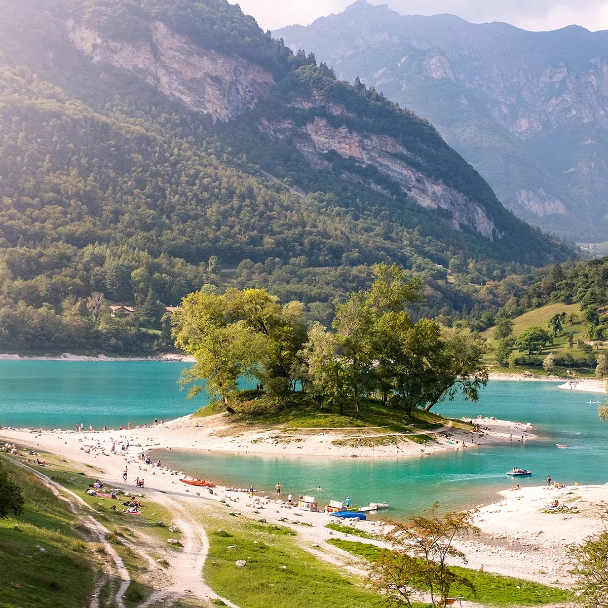
An adrenaline-infused and challenging descent that repays the exertions of the ascent to Tremalzo.

Signage: 779a. Variante Caset Rinalt - Trail

The first part, between Rifugio Garibaldi and Bocca Caset, unfolds on a relatively even forest road, whereas the descent proper happens in the second half of this route, as the trail gets narrower and the surface more uneven.

Further information and useful links
Picked your route? Now find the right experts to go with it. Make the most of every ride with support from local MTB specialists – from guides and rentals to shuttle services and workshops.
details
  • Linear route
  • Fauna
  • Refreshment stops available
Route info
Easy
Route number
779a
Distance
8,1 km
Duration
1 h 00 min
Altitude difference (+)
140 m
Altitude difference (-)
910 m
Physical effort
Scenary
Highest point
1.644 m
Lowest point
748 m
Suggestions

Every year from August to October migratory bird en route to Africa fly over Bocca Caset. In this period the scientists from Muse – Museum of natural science – are at work day and night to study this incredible phenomenon and organize workshops and activities for curious passers-by.

You might be interested in
Discover related tours
Along the lake promenade | © Archivio APT Garda Trentino (ph. R. Kiaulehn), Garda Trentino
Easy
Torbole sul Garda - Nago, Riva del Garda, Arco
Monte Brione Family Tour
Distance 8,5 km
Duration 50 min
Altitude difference (+) 68 m
Altitude difference (-) 68 m
Status
open
View of the Valle del Chiese and Lake Idro | © Archivio Garda Trentino (ph. Dario Zontini), North Lake Garda Trentino
Difficult
Ledro
Ampola Storo Trail - Tour
Distance 45,1 km
Duration 7 h 30 min
Altitude difference (+) 1.850 m
Altitude difference (-) 1.850 m
Status
open
Lake Cavedine, with snowy Paganella in the background | © Archivio Garda Trentino (ph. Marco Giacomello), Garda Trentino
Easy
Valle dei Laghi, Dro & Drena
Passo S. Uldarico (Cross Country)
Distance 14,5 km
Duration 2 h 00 min
Altitude difference (+) 490 m
Altitude difference (-) 490 m
Status
open
An example of the terrain on the 409B Trail | © M. Giacomello, Garda Trentino
Easy
Arco
Variante Piazzole - Trail
Distance 4,0 km
Duration 15 min
Altitude difference (+) 10 m
Altitude difference (-) 720 m
Status
open
Trail descending from Malga Grassi | © Archivio Garda Trentino (ph. Tommaso Prugnola), Garda Trentino
Intermediate
Riva del Garda, Tenno
Malga Grassi Trail-Tour
Distance 24,2 km
Duration 4 h 00 min
Altitude difference (+) 1.130 m
Altitude difference (-) 1.130 m
Status
open
Malga Zanga | © Malga Zanga, North Lake Garda Trentino
Easy
Val di Gresta, Arco, Surroundings
Santa Barbara Variant Trail
Distance 6,1 km
Duration 50 min
Altitude difference (+) 180 m
Altitude difference (-) 330 m
Status
open