aria.quick_link.navi aria.quick_link.skiptomaincontent aria.quick_link.footer
Garda Trentino Logo
Top

The forts of Monte Brione

Arco, Riva del Garda

Category
Difficulty
Easy
Duration
3:00
Duration in hours
Distance
6.1
Distance in km
Status
open
Suggested period
Jan
Feb
Mar
Apr
May
Jun
Jul
Aug
Sep
Oct
Nov
Dec

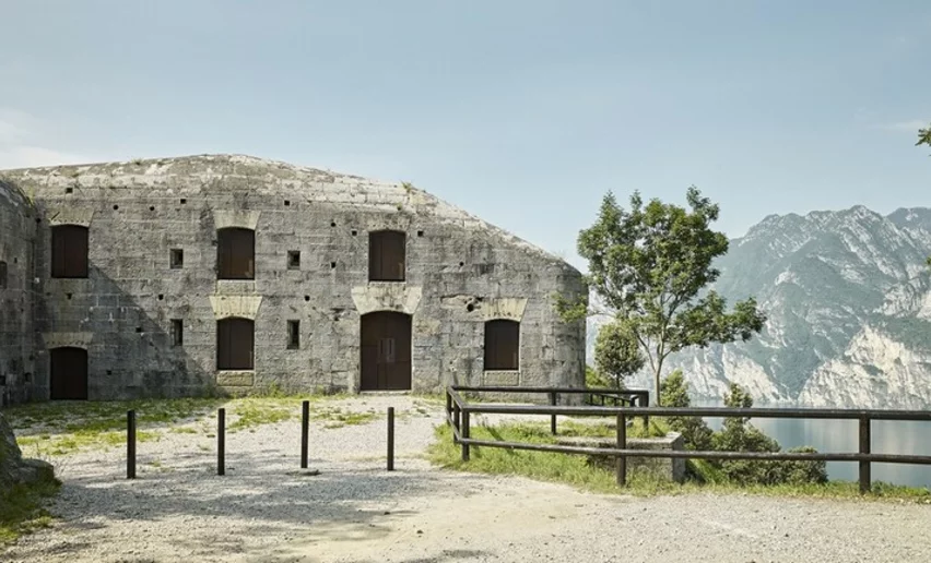
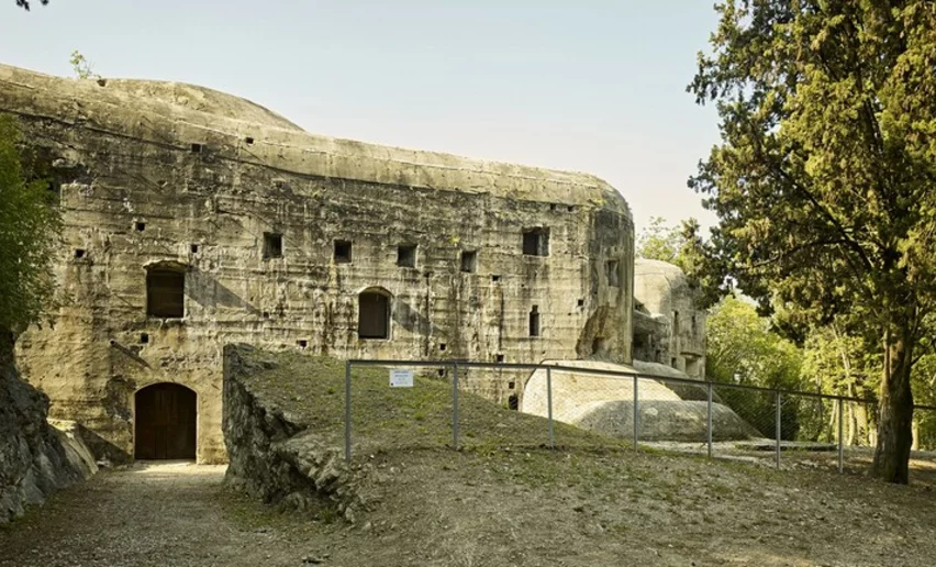
An easy trek to explore the Austro-Hungarian border defences along the Sentiero della Pace or Peace Trail

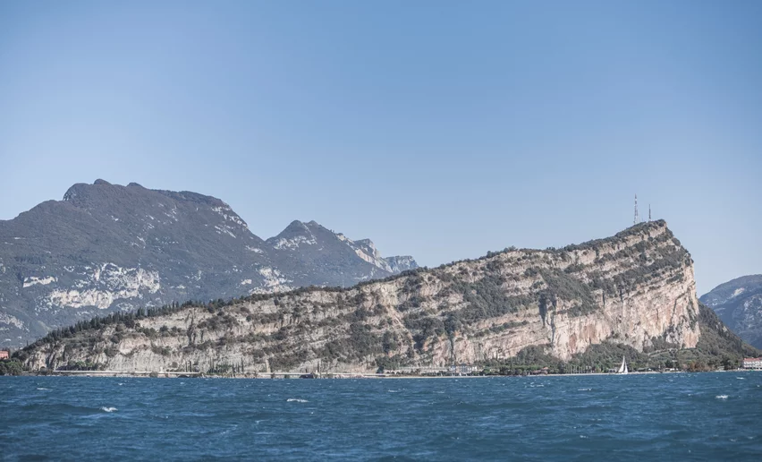
Up until 1918 Garda Trentino belonged to the Austro-Hungarian Empire which, well aware of the strategic position of the area, went about constructing a serious system of defences which centred on Monte Brione. Apart from bearing visible traces of that period, Monte Brione is also a protected area because of the high level of biodiversity of its typical Mediterranean vegetation.

Brione is home to 817 species of plant, 35% of the entire flora of Trentino! Many of these are rare or endangered species and some grow here alone, on the shores of Lake Garda. In particular, there is an extraordinary variety of orchids with 26 known species. This is the reason why the top of Monte Brione is recognised as protected area. 

Further information and useful links

For information and guided tours of the forts, visit the MAG - Museo Alto Garda website.

For more information on routes, services (guides, mountain huts, shops etc.) and hiking friendly accommodation: Garda Trentino - +39 0464 554444

details
  • Scenic
  • Insider tip
  • Summit route
  • Round trip
  • Family-friendly
  • Cultural/historical interest
  • Flora
Route info
Easy
Route number
Distance
6,1 km
Duration
3 h 00 min
Altitude difference (+)
375 m
Altitude difference (-)
375 m
Physical effort
Scenary
Highest point
357 m
Lowest point
66 m
Suggestions

The Austro-Hungarian Empire built a series of forts to protect the northern shore of Lake Garda: the “Festung Abschnitt”. In the middle of the system was Monte Brione with its Forte San Nicolò (1860-62) close to the lake, Forte S. Alessandro (1881) on the top, and in the middle Forte Batteria di Mezzo (1900) and Forte Garda (1907).

Discover the impressive views over Lake Garda.

You might be interested in
Discover related tours
© fototeca trentino sviluppo foto di b. bolchi, Garda Trentino
Intermediate
Comano
Monte San Martino nel Lomaso (da Lundo)
Distance 5,8 km
Duration 2 h 30 min
Altitude difference (+) 320 m
Altitude difference (-) 323 m
Status
open
Canyon Limarò | © Fototrekking Foto D. Lira, North Lake Garda Trentino
Intermediate
Comano
Sentiero dell'Acqua
Distance 10,2 km
Duration 3 h 15 min
Altitude difference (+) 416 m
Altitude difference (-) 416 m
Status
open
Wayside shrine near Bolognano | © Archivio APT Garda Trentino , North Lake Garda Trentino
Intermediate
Dro & Drena, Arco
GardaTrek - Medium Loop 3: from Ceniga to Bolognano
Distance 19,8 km
Duration 8 h 20 min
Altitude difference (+) 891 m
Altitude difference (-) 868 m
Status
open
Flower meadows | © Stefania Oradini, Garda Trentino
Intermediate
Riva del Garda, Ledro
Monte Tomeabrù
Distance 9,7 km
Duration 4 h 30 min
Altitude difference (+) 455 m
Altitude difference (-) 461 m
Status
open
View from Segrom | © Archivio APT Garda Trentino, North Lake Garda Trentino
Intermediate
Torbole sul Garda - Nago, Arco, Riva del Garda
Garda Trek - Medium Loop 4: From Bolognano to Riva del Garda
Distance 23,1 km
Duration 8 h 25 min
Altitude difference (+) 953 m
Altitude difference (-) 1.045 m
Status
open
view from the top of Biaena over the lower Vallagarina | © ApT Rovereto Vallagarina Monte Baldo - Prodotto Outdoor, Garda Trentino
Easy
Val di Gresta
From Passo Bordala to Monte Biaena
Distance 3,7 km
Duration 1 h 40 min
Altitude difference (+) 353 m
Altitude difference (-) 9 m
Status
open