aria.quick_link.navi aria.quick_link.skiptomaincontent aria.quick_link.footer
Garda Trentino Logo
Top

Ponale Path (from Riva del Garda)

Riva del Garda, Ledro

Category
Difficulty
Easy
Duration
3:00
Duration in hours
Distance
6.4
Distance in km
Status
open
WSEN
Suggested period
Jan
Feb
Mar
Apr
May
Jun
Jul
Aug
Sep
Oct
Nov
Dec

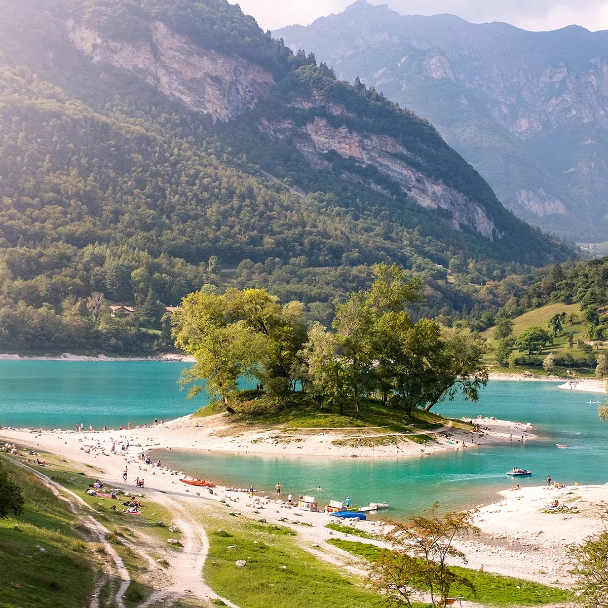
Ponale Trail is the best known and most popular in Garda Trentino: spectacular as its winds sheer above the lake, a classic trek you can't afford to miss.

The line of the Old Ponale Road stands out against the mountainside and is clearly visible from the beaches in Riva and Torbole. The Ponale trail is an icon of Garda Trentino, much loved by visitors and locals alike who never tire of the spectacular views it offers at every bend.

The Ponale Road was opened to road traffic at the end of the 80s with the opening of the new tunnel to Valle di Ledro which was subsequently turned into a hiking path in 2004.

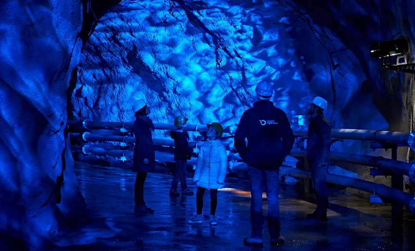
The Ponale Road is famous not only for the unequalled panorama of the lake but also for the military installations you can see along the trail. When you come to the second and third tunnels you can see remains of the Tagliata del Ponale, imposing fortifications built by the Austro-Hungarians from 1860 onwards which consist of tunnels excavated into the rock and trenches which stretch from lake level to the outposts overlooking the current trail. Today the Tagliata complex is normally closed to the public for reasons of safety.


Further information and useful links

For more information on routes, services (guides, mountain huts, shops etc.) and hiking friendly accommodation: Garda Trentino - +39 0464 554444


Route info
Easy
Route number
Distance
6,4 km
Duration
3 h 00 min
Altitude difference (+)
736 m
Altitude difference (-)
272 m
Physical effort
Scenary
Highest point
532 m
Lowest point
65 m
Suggestions

Ponale Road was begun in 1851, an ambitious project to link Lake Garda and Lake Ledro which up till then had been cut off from the rest of Trentino

You might be interested in
Discover related tours
View from the old "Maza"-road | © Archivio Garda Trentino, Garda Trentino
Intermediate
Torbole sul Garda - Nago, Arco, Riva del Garda, Tenno
Garda Trek - Low Loop: in the heart of Garda Trentino
Distance 32,4 km
Duration 12 h 25 min
Altitude difference (+) 1.145 m
Altitude difference (-) 1.170 m
Status
open
© Natalia Pellegrini, Garda Trentino
Intermediate
Ledro
Monte Cocca
Distance 8,4 km
Duration 3 h 30 min
Altitude difference (+) 750 m
Altitude difference (-) 750 m
Status
open
© Fototeca Trentino Sviluppo foto di A. Russolo, Garda Trentino
Easy
Comano
Credata Fort
Distance 3,9 km
Duration 1 h 00 min
Altitude difference (+) 281 m
Altitude difference (-) 283 m
Status
open
The Sarca Valley, view from the "Schoolteacher's Trail" | © Archivio APT Garda Trentino, Garda Trentino
Intermediate
Arco, Dro & Drena
Sentiero della Maestra- "Teacher's Trail" in Val del Sarca
Distance 11,6 km
Duration 4 h 15 min
Altitude difference (+) 495 m
Altitude difference (-) 493 m
Status
open
Vista sul Garda | © Staff Outdoor Garda Trentino AC, Garda Trentino
Intermediate
Ledro
Cima Rocca
Distance 7,8 km
Duration 3 h 30 min
Altitude difference (+) 799 m
Altitude difference (-) 668 m
Status
open
The forts of Monte Brione | © Archivio Garda Trentino (ph. Watchsome), Garda Trentino
Easy
Riva del Garda, Arco
The forts of Monte Brione
Distance 6,1 km
Duration 3 h 00 min
Altitude difference (+) 375 m
Altitude difference (-) 375 m
Status
open