Garda Trentino Logo
Top

Ledro Sky Trentino Grand Finale

Ledro, Riva del Garda

Difficulty
Difficult
Duration
5:00
Duration in hours
Distance
21.8
Distance in km
Status
open
Suggested period
Jan
Feb
Mar
Apr
May
Jun
Jul
Aug
Sep
Oct
Nov
Dec

ROUTE STILL BEING DEFINED

A route tracing the Ledro Sky course, extended by a few kilometers and additional elevation gain for the Grand Finale of the Golden Trail World Series organized by Salomon.

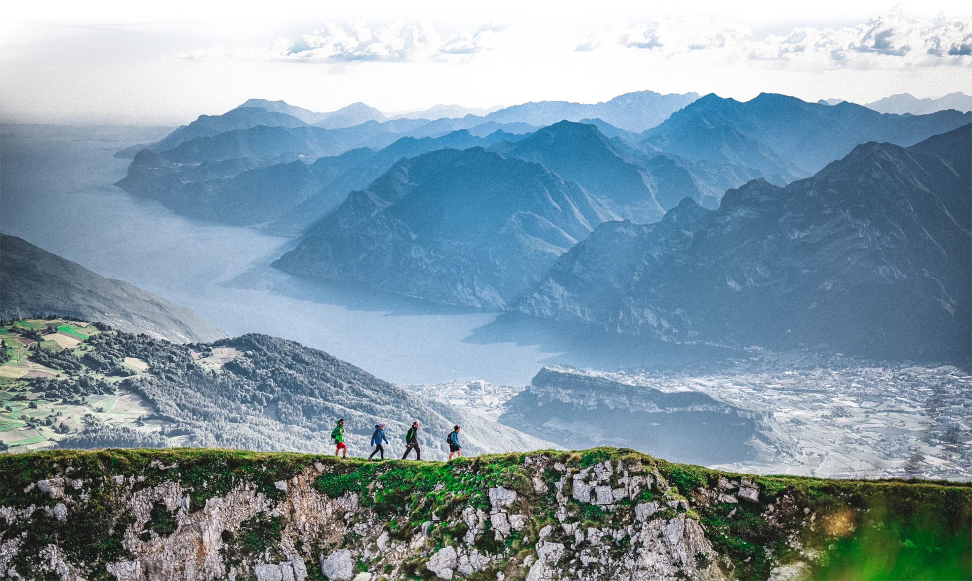
A route that, after surpassing the treeline, develops along the ridge offering participants breathtaking panoramas stretching from the Brenta Dolomites to Lakes Ledro and Garda.

The ridge section lies within the SIC Crinale Pichea-Rocchetta, renowned for its significant natural and wildlife value, and is part of the UNESCO Judicaria Biosphere Reserve.

Route info
Difficult
Route number
Distance
21,8 km
Duration
5 h 00 min
Altitude difference (+)
1.740 m
Altitude difference (-)
1.740 m
Physical effort
Scenary
Highest point
1.987 m
Lowest point
652 m
Suggestions

From the ridges, you can enjoy a panorama overlooking four lakes: Ledro, Garda, Tenno, and Molveno.

Safety guidelines

The path linking Cima Parì to Bocca Dromaè is technically demanding and requires particular caution.

Please note that the practicability of the itineraries in a mountain environment is strictly linked to the contingent conditions and is therefore influenced by natural phenomena, environmental changes and weather conditions. For this reason, the information contained in this page may have changed. Before leaving for a tour, make sure the path you will approach is still accessible by contacting the owner of the mountain hut, the alpine guides or the visitor centres of the nature parks, the info offices of the local tourist board.

Punto di partenza
Pieve di Ledro
Directions

From the starting point, the route first follows the lakeside path towards Mezzolago, then connects to the Ledro Trek Low trail before joining the SAT 454 path, which climbs towards Malga Saval. After passing Sella della Cocca, the trail continues until it reaches the Saval pastures. From Malga Saval, the ascent continues towards Monte Carèt, followed by a descent to Bocca Saval, where the climb to Cima Parì begins. From the summit, the "Senter dele Greste" begins. Continuing along the ridge, staying at high altitude, the route leads to Cima Sclapa. A steep descent brings you to Bocca Dromaè, from where the trail climbs again towards Cima d’Oro. Following the World War I trenches, you reach the Coste di Salò area, where the botanical trail begins, leading to Fior di Bella. At Mezzolago, the trail joins the "Sentiero dei Piloni" (part of the Ledro Trek Low) to return to Pieve.

public transportation

Valle di Ledro is connected to Riva del Garda by the intercity bus line 214 (Riva-Valle di Ledro-Storo).

Up-to-date information on timetables and routes.

How to get there

Exit the A22 motorway at Rovereto Sud – Lago di Garda. Follow the SS240 della Val di Ledro to Pieve di Ledro

Where to park

Parking spaces available in Pieve di Ledro 

You might be interested in
Discover related tours
© Galvagni Foto - Archivio Garda Trentino Trail, Garda Trentino
Difficult
Tenno, Arco, Riva del Garda, Ledro
Garda Trentino Trail
Distance 69,3 km
Duration 16 h 00 min
Altitude difference (+) 4.519 m
Altitude difference (-) 4.529 m
Status
open
Cima Giochello | © Garda Trentino Trail , Garda Trentino
Difficult
Riva del Garda
Vertical Crazidei
Distance 11,7 km
Duration 3 h 30 min
Altitude difference (+) 1.501 m
Altitude difference (-) 1.501 m
Status
closed
View from Punta Larici | © Garda Trentino Trail , Garda Trentino
Intermediate
Ledro, Riva del Garda
Ponale - Larici - Rocchetta
Distance 21,8 km
Duration 5 h 40 min
Altitude difference (+) 1.384 m
Altitude difference (-) 1.384 m
Status
open
To Tenno | © Garda Trentino Trail , Garda Trentino
Difficult
Riva del Garda, Torbole sul Garda - Nago, Tenno, Arco
Garda Trentino Xmas Trail
Distance 30,7 km
Duration 6 h 25 min
Altitude difference (+) 1.311 m
Altitude difference (-) 1.313 m
Status
open
© Samuele Guetti, Garda Trentino
Difficult
Comano, Tenno, Ledro
Comano Ursus Extreme Trail
Distance 26,5 km
Duration 7 h 00 min
Altitude difference (+) 2.150 m
Altitude difference (-) 2.150 m
Status
open
View from the top of Monte Misone | © Archivio Garda Trentino - Foto G.P. Calzà, Garda Trentino
Difficult
Comano, Tenno
Trail running to Mount Misone
Distance 19,3 km
Duration 4 h 40 min
Altitude difference (+) 1.437 m
Altitude difference (-) 1.436 m
Status
open