Logo Garda
Top
Hidden Treasures: Treasures of Sacral Art in Arco
Arco, Dro & Drena
Add to favourites
Category
Difficulty
Easy
Activity time
2:35
Duration in hours
Distance
9.7
Distance in km
Status
open
Suggested period
Jan
Feb
Mar
Apr
May
Jun
Jul
Aug
Sep
Oct
Nov
Dec
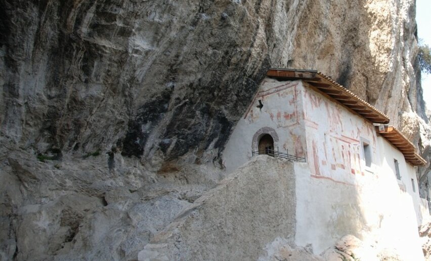
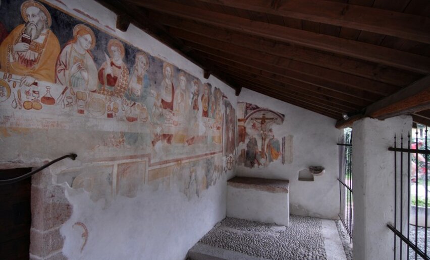
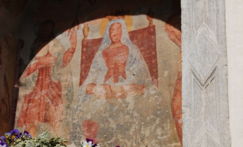
An easy itinerary which focuses on the historic frescoed churches around Arco, little known gems, the perfect walking tour for lovers of art and architecture.

This itinerary focuses on the historic frescoed churches around Arco which bear witness to the deep roots of the local faith. What we are dealing with here are chapels, little churches of outlying hamlets, and shrines which tell of a simple yet widespread faith, with close links to local rural tradition (to find out more about this theme we suggest the trail about Nago and the religious faith of the country people).

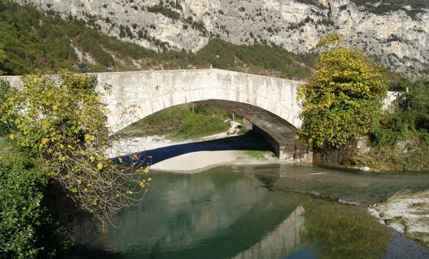
This is a loop along the banks of the River Sarca, on both sides of the river, and touching on Ceniga (municipality of Dro), San Martino and Bolognano. This area is part of the Sarca River Reserve, a nature reserve designed to protect the particular environments around the river.

So this itinerary invites you not only to discover the artistic treasures of the area but also to enjoy the particular landscape which is dominated by the river.

Further information and useful links
  • Some of the churches are not open to the public all year round but only during the summer months or on request, asking the caretaker for the keys. You should therefore check first whether the churches are open. For opening times and information: www.gardatrentino.it
  • For further information on routes, activities, events and accommodation at lake Garda:  APT Garda Trentino, Tel. +39 0464 554444 - www.gardatrentino.it
Route info
Easy
Route number
Distance
9,7 km
Activity time
2 h 35 min
Altitude difference (+)
77 m
Altitude difference (-)
77 m
Technical skills
Physical effort
Scenary
Highest point
162 m
Lowest point
85 m
Suggestions
As well as visiting the churches located along this trail you could also stop by at the church of San Antonio in Chiarano, which is one of the stages on the “Rilke Promenade”
Safety guidelines

The Hidden Treasures itineraries were designed in order to give visitors a chance to get to know places in Garda Trentino that are off the beaten track. For this reason, the signposting is not always in the same style and sometimes missing altogether. We therefore recommend you to take a good map with you on these excursions. And then bear in mind your general reference points: Lake Garda = South, Monte Stivo = East, Rocchetta = West, Arco Castle = North.

The telephone number for the emergency services is 112.

The information on this chart is subject to inevitable variations, so this means that none of the indications are absolute. It is not entirely possible to avoid giving inexact or imprecise information, given how quickly environmental and weather conditions can change. For this reason we decline any responsibility for changes which the user may encounter. In any case,  the hiker is advised to check the conditions of the places, environment and weather before setting out.

Punto di partenza
Arco - city center
Directions

Starting from the "Al Ponte" car park, take Via Caproni Maini and follow it for about 500 metres. At the intersection with Via Legionari Cecoslovacchi, you will find the little church of Sant' Apollinare. Continue on the paved road along the River Sarca in the direction of Ceniga. After about 3 km there is a signpost marking a detour for the hermitage Eremo di San Paolo, situated on the cliff beneath Monte Colt to the left of the trail.

When you get to Ceniga, cross the Roman bridge and continue as far as the next crossroads where you turn right until you come to the start of the cycle path for Arco. Continue along the cycle path as far as the bar in Moletta where you turn left towards the town. Cross the main road at the traffic lights and take Via San Martino. After about 1 km, follows the signs to the church dedicated to San Martino. Return to where you left the road and continue along Via Maffei until Piazza Ribbia in Massone.

Leaving the fountain behind you, turn into via Bezzecca and continue south towards the intersection with via Europa and the chapel "Cappella dei Sette Dolori", which was recently restored. Cross the road in the direction of the cemetery and then keep going, first along via Madonnina and then via Indipendenza to Piazza S. Rocco in Caneve, where you will find the little church of San Rocco, the patron saint who protects from the plague.

public transportation

The towns in Garda Trentino - Riva del Garda, Torbole sul Garda, Nago and Arco – are connected by a number of urban and intercity bus lines which will take you to the starting point of the trail. For up-to-the-minute information on timetables and routes: www.gardatrentino.it

How to get there

Getting to northern lake Garda / Garda Trentino: www.gardatrentino.it 

Where to park

Free parking in Caneve (5 minutes on foot from the centre of Arco).

Pay parkng Foro Boario, Via Caproni Maini (Parcheggio al Ponte), Posta (Via Monache).

This excursion is quite simple and presents no particular difficulty. However, we still recommend you to wear suitable footwear, a hat, sun screen and sunglasses. And be sure to bring water!
You might be interested in
Discover related tours
Arco
Distance 2,9 km
Activity time 1 h 00 min
Altitude difference (+) 111 m
Status
open
Valle dei Laghi
Distance 6,8 km
Activity time 2 h 00 min
Altitude difference (+) 240 m
Status
open
Comano
Distance 7,6 km
Activity time 2 h 00 min
Altitude difference (+) 224 m
Status
open
Riva del Garda
Distance 4,3 km
Activity time 1 h 30 min
Altitude difference (+) 196 m
Status
open
Ledro
Distance 4,3 km
Activity time 1 h 30 min
Altitude difference (+) 142 m
Status
open
Comano
Distance 4,0 km
Activity time 1 h 30 min
Altitude difference (+) 38 m
Status
open