aria.quick_link.navi aria.quick_link.skiptomaincontent aria.quick_link.footer
Garda Trentino Logo
Top

San Giovanni al Monte

Arco, Dro & Drena, Riva del Garda

Category
Difficulty
Intermediate
Duration
2:30
Duration in hours
Distance
32.4
Distance in km
Status
open
Suggested period
Jan
Feb
Mar
Apr
May
Jun
Jul
Aug
Sep
Oct
Nov
Dec
Twenty small bends take us to the San Giovanni al Monte area, at an altitude of 1050 metres above sea level. Its exceptionally taxing climbs are rewarded by astounding views. 

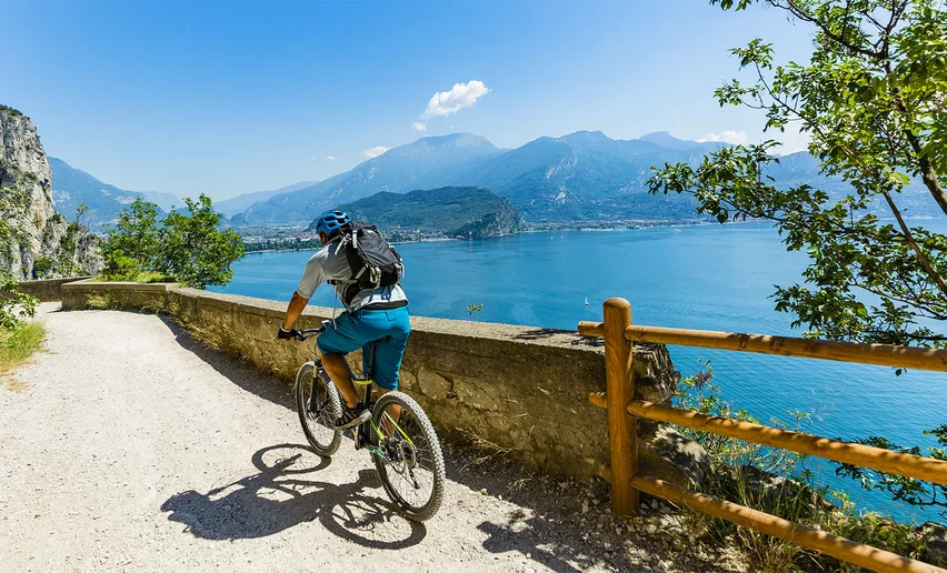
This route proposes the climb to San Giovanni al Monte, splendid mountain location reachable from Arco. The road, along which panoramic sections alternate with sections nestled in the wood, presents tough gradients, especially at the beginning.

It’s a challenging climb and its numerous bends offer the only relief from the effort needed to tackle it. Once we’ve reached San Giovanni, the surfaced road ends and for the racing bike, the climb ends here. But before returning, we can recharge our batteries, eat, and rehydrate at the malga.

Further information and useful links
From epic climbs to fast descents, every detail matters. Ride worry-free with help from our road cycling specialists: rentals, mechanics and guides who speak your language – the language of smooth tarmac and two wheels.
details
  • Scenic
  • Geological highlights
  • Insider tip
  • Out and back
  • Refreshment stops available
  • Flora
Route info
Intermediate
Route number
Distance
32,4 km
Duration
2 h 30 min
Altitude difference (+)
2.166 m
Altitude difference (-)
2.167 m
Technical skills
Physical effort
Scenary
Highest point
1.071 m
Lowest point
70 m
Suggestions
The climb is long and hard, but full of bends: make the most of these to catch your breath between one steep slope and another.
You might be interested in
Discover related tours
View over Lake Toblino and the Valle dei Laghi | © Archivio APT Garda Trentino (ph. R. Kiaulehn), North Lake Garda Trentino
Intermediate
Valle dei Laghi, Arco, Dro & Drena
Tour della Valle dei Laghi
Distance 64,8 km
Duration 4 h 25 min
Altitude difference (+) 570 m
Altitude difference (-) 570 m
Status
open
The small harbor in Torbole | © Archivio Garda Trentino, Garda Trentino
Difficult
Torbole sul Garda - Nago, Surroundings
Monte BaldoTour
Distance 116,9 km
Duration 8 h 00 min
Altitude difference (+) 2.300 m
Altitude difference (-) 2.300 m
Status
open
Lago di Garda | © Archivio APT Garda Trentino, Garda Trentino
Intermediate
Torbole sul Garda - Nago
Malcesine Panoramic Road
Distance 34,6 km
Duration 2 h 49 min
Altitude difference (+) 432 m
Altitude difference (-) 432 m
Status
open
View over Lake Garda | © Archivio APT Garda Trentino, Garda Trentino
Difficult
Torbole sul Garda - Nago, Surroundings, Val di Gresta, Arco
Monte Velo - Santa Barbara - Loppio
Distance 41,1 km
Duration 3 h 00 min
Altitude difference (+) 1.237 m
Altitude difference (-) 1.214 m
Status
open
View of the northern shore of Lake Ledro | © Roberto Vuilleumier, Garda Trentino
Difficult
Ledro, Comano, Riva del Garda, Tenno
Durone - Valle del Chiese - Valle di Ledro
Distance 91,8 km
Duration 5 h 00 min
Altitude difference (+) 2.172 m
Altitude difference (-) 1.851 m
Status
open
Malga Campo | © APT Garda Trentino (ph. Matteo ISchia) , Garda Trentino
Difficult
Riva del Garda, Dro & Drena, Arco
Drena - Malga Campo
Distance 54,0 km
Duration 5 h 00 min
Altitude difference (+) 1.328 m
Altitude difference (-) 1.328 m
Status
open