aria.quick_link.navi aria.quick_link.skiptomaincontent aria.quick_link.footer
Garda Trentino Logo
Top

Garda Trek - LowLoop 2: from Arco to Riva del Garda

Torbole sul Garda - Nago, Arco, Riva del Garda

Category
Difficulty
Intermediate
Duration
7:10
Duration in hours
Distance
19.2
Distance in km
Status
closed
Suggested period
Jan
Feb
Mar
Apr
May
Jun
Jul
Aug
Sep
Oct
Nov
Dec

The second stage of the Low Loop takes you back to Riva del Garda, touching on Nago and Torbole, then following the lake shore to the point you started from, exploring the eastern shore of Garda Trentino.

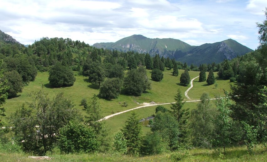
The second stage also winds its way along what today are secondary roads but were once the main communication routes in Garda Trentino. Crossing terraced farmland, you touch on key locations in local history while the final stage takes you along the shore where the main focus is Lake Garda itself.

Further information and useful links

For more information on routes, services (guides, mountain huts, shops etc.) and hiking friendly accommodation: Garda Trentino - +39 0464 554444

details
  • Linear route
  • Multi-stage route
  • Scenic
  • Geological highlights
  • Refreshment stops available
  • Cultural/historical interest
  • Flora
Route info
Intermediate
Route number
Distance
19,2 km
Duration
7 h 10 min
Altitude difference (+)
543 m
Altitude difference (-)
569 m
Physical effort
Scenary
Highest point
303 m
Lowest point
62 m
Suggestions

Shortly before you reach Nago, the trail passes the Belvedere: take a few minutes to stop and admire the view over the entire northern end of Lake Garda.

The Low Loop intersects with some of the itineraries in the “Hidden Treasures” series, recommended for anyone interested in the history, literary connections and art of Garda Trentino. You can, for example, follow in the footsteps of Goethe, who wrote about his stay in Torbole in his Travels in Italy. Or you can walk along a stretch of the “Blue Line”, the last line of defence built at the foot of the Italian Alps by the German armed forces in 1944-45.  Info about the different routes and free gps-tracks are available on our website.

You might be interested in
Discover related tours
Bunker from WWII - Dos Tenim (Nago - Torbole) | © Staff Outdoor GardaTrentino MM, Garda Trentino
Intermediate
Torbole sul Garda - Nago, Arco, Riva del Garda
The "Blue Line" of Garda Trentino
Distance 15,2 km
Duration 5 h 20 min
Altitude difference (+) 291 m
Altitude difference (-) 293 m
Status
open
The village Campi | © Archivio Garda Trentino, Garda Trentino
Difficult
Riva del Garda
The Old Pinza Road
Distance 10,5 km
Duration 4 h 32 min
Altitude difference (+) 8 m
Altitude difference (-) 1.512 m
Status
open
Strada di Moline and Deggia | © Fototeca Trentino Sviluppo foto di A. Russolo, Garda Trentino
Intermediate
Valle dei Laghi
The S. Vili’s path: through Deggia, Moline & Ranzo
Distance 13,9 km
Duration 5 h 00 min
Altitude difference (+) 641 m
Altitude difference (-) 641 m
Status
open
Madonnina di Besta | © Archivio Garda Trentino (ph. Watchsome), Garda Trentino
Intermediate
Ledro
Giro della Madonnina di Besta
Distance 6,5 km
Duration 2 h 30 min
Altitude difference (+) 399 m
Altitude difference (-) 399 m
Status
open
view of Ronzo and Garda from Monte Biaena | © ApT Rovereto Vallagarina Monte Baldo, Garda Trentino
Intermediate
Val di Gresta
#15) From Ronzo Chienis to Rovereto
Distance 18,3 km
Duration 6 h 15 min
Altitude difference (+) 713 m
Altitude difference (-) 1.491 m
View from the top of Monte Misone | © Archivio Garda Trentino - Foto G.P. Calzà, Garda Trentino
Intermediate
Tenno
On the summit of Monte Misone
Distance 8,2 km
Duration 4 h 15 min
Altitude difference (+) 860 m
Altitude difference (-) 857 m
Status
open