aria.quick_link.navi aria.quick_link.skiptomaincontent aria.quick_link.footer
Garda Trentino Logo
Top

Marocche Nature Reserve

Dro & Drena

Category
Difficulty
Intermediate
Duration
2:00
Duration in hours
Distance
6.1
Distance in km
Status
open
Suggested period
Jan
Feb
Mar
Apr
May
Jun
Jul
Aug
Sep
Oct
Nov
Dec

A walk in a truly unique environment in another dimension of time and space

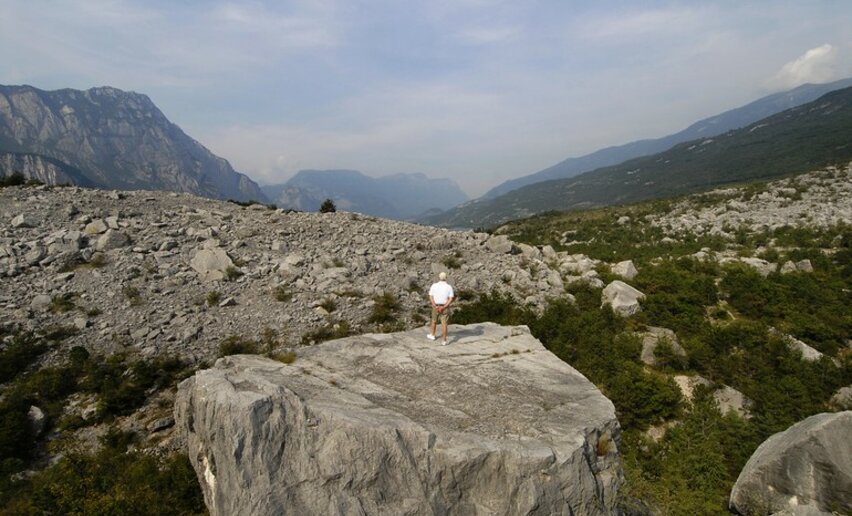
This nature reserve, meaning an area which is protected because of its unique natural and geological features, is the largest post-glacial landslide in the entire Alps: an imposing mass of rocky debris which gives the area a lunar appearance and a habitat for plants and animals which have adapted to this particularly arid environment.

During your visit be sure to examine the dinosaur tracks on a great boulder along the trail: they date back to over 100 million years ago! And if you are into botany, watch out for the natural bonsais you will find among the rocks: they are true “dwarf trees” which due to the harsh environmental conditions have short branches and underdeveloped trunks. These trees do not usually manage to grow more than a metre high, even though they are often over a hundred years old.

The Marocche di Dro are a Site of Community Importance, belonging to the Natura 2000 Network. 


Further information and useful links

For more information on routes, services (guides, mountain huts, shops etc.) and hiking friendly accommodation: Garda Trentino - +39 0464 554444

details
  • Scenic
  • Geological highlights
  • Round trip
  • Flora
Route info
Intermediate
Route number
Distance
6,1 km
Duration
2 h 00 min
Altitude difference (+)
166 m
Altitude difference (-)
148 m
Physical effort
Scenary
Highest point
298 m
Lowest point
179 m
Suggestions

Some curiosity: the name "Marocche" comes from local dialect: "maroc" means boulder, a big lump of rock.

Local legends say that this place was once the city of Kas, whose inhabitants were known for their immorality. The Lord, tired of their dissolute behaviour, caused the surrounding mountains to crumble away, burying the town under a gigantic landslide that we now call Marocche.


You might be interested in
Discover related tours
Sentiero Busatte - Tempesta | © Archivio APT Garda Dolomiti - A. Galvagni , Garda Trentino
Easy
Torbole sul Garda - Nago
Sentiero Busatte Tempesta
Distance 7,9 km
Duration 2 h 40 min
Altitude difference (+) 305 m
Altitude difference (-) 295 m
Status
open
Ca' de Mez | © Staff Outdoor Garda Trentino AC, Garda Trentino
Difficult
Ledro
Molina Hut Circuit
Distance 13,8 km
Duration 6 h 00 min
Altitude difference (+) 1.286 m
Altitude difference (-) 1.288 m
Status
open
Sunset from the Madonnina di Besta | © Giorgio Dubini, Garda Trentino
Intermediate
Ledro
Ledro Trek Medium - Stage 1
Distance 11,0 km
Duration 5 h 00 min
Altitude difference (+) 942 m
Altitude difference (-) 1.006 m
Status
open
The village of Rango | © Archivio Garda Trentino (ph. Watchsome), Garda Trentino
Easy
Comano
Between Rango, Balbido and Passo Durone
Distance 8,3 km
Duration 2 h 45 min
Altitude difference (+) 357 m
Altitude difference (-) 357 m
Status
open
Walking, what a passion | © Fototeca Trentino Sviluppo foto di A. Russolo, Garda Trentino
Intermediate
Valle dei Laghi, Comano
At Passo della Morte: between nature and legend
Distance 7,7 km
Duration 3 h 30 min
Altitude difference (+) 299 m
Altitude difference (-) 547 m
Status
open
Cross below Pichea | © Daniele Mosna, Garda Trentino
Easy
Riva del Garda, Ledro
Galleria Riccabona
Distance 2,2 km
Duration 1 h 00 min
Altitude difference (+) 223 m
Altitude difference (-) 7 m
Status
open