aria.quick_link.navi aria.quick_link.skiptomaincontent aria.quick_link.footer
Garda Trentino Logo
Top

Monte Misone

Tenno, Comano

Category
Difficulty
Intermediate
Duration
3:15
Duration in hours
Distance
25.5
Distance in km
Status
open
Suggested period
Jan
Feb
Mar
Apr
May
Jun
Jul
Aug
Sep
Oct
Nov
Dec

Magnificent circuit around the entire Monte Misone massif.

Signage: 1801. Monte Misone - Tour

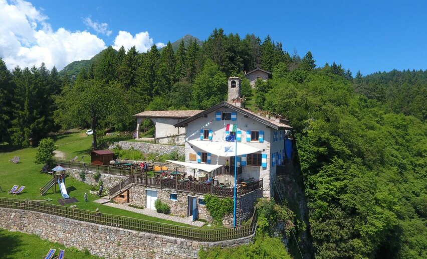
From Fiavé, begin on minor roads and forest tracks, proceeding easily to Passo del Ballino without any major climbing. From there it’s just under 1.5 km to the village of Ballino, which, unfortunately, you have to pass on a main road. But the rest of the tour is a true delight. Pass through shady woodland until you arrive just above Lago di Tenno, which you should definitely visit. The route then leads uphill along the sunny south-western flanks of Monte Misone. A final climb takes you up to Sella di Callino, the highest point of the tour. From there you can take it easy as you coast through the scenic Val Lomasona, with a short climb back to the starting point at the very end.

Further information and useful links
Picked your route? Now find the right experts to go with it. Make the most of every ride with support from local MTB specialists – from guides and rentals to shuttle services and workshops.
details
  • Scenic
  • Round trip
Route info
Intermediate
Route number
1801
Distance
25,5 km
Duration
3 h 15 min
Altitude difference (+)
730 m
Altitude difference (-)
730 m
Physical effort
Scenary
Highest point
967 m
Lowest point
495 m
Suggestions

It can get quite hot there in summer, so you’ll be glad, after just over 12 km, to take a detour for some refreshments at the Rifugio San Pietro.

You might be interested in
Discover related tours
Biking Garda Trentino | © ph_Castagna_BIKEFESTIVAL_SHOOT, Garda Trentino
Difficult
Riva del Garda
Bike Festival Test Trail - Brione
Distance 8,4 km
Duration 1 h 20 min
Altitude difference (+) 260 m
Altitude difference (-) 269 m
Status
open
Towards the Passo dei Gatùm from Passo Tremalzo | © Archivio Garda Trentino (ph. Giorgio Dubini), Garda Trentino
Difficult
Ledro
Tremalzo Big - Tour
Distance 45,8 km
Duration 6 h 00 min
Altitude difference (+) 1.720 m
Altitude difference (-) 1.720 m
Status
open
The road between Ranzo and Lon | © Archivio Garda Trentino (ph. Tommaso Prugnola), Garda Trentino
Difficult
Valle dei Laghi
Valle dei Laghi Trail-Tour
Distance 43,8 km
Duration 6 h 00 min
Altitude difference (+) 1.420 m
Altitude difference (-) 1.420 m
Status
open
Lago di Cavedine | © Archivio Garda Trentino (ph. Watchsome), Garda Trentino
Easy
Valle dei Laghi, Dro & Drena
Cavedine Shortcut
Distance 7,1 km
Duration 40 min
Altitude difference (+) 4 m
Altitude difference (-) 7 m
The cycle path along river Sarca | © M. Giacomello, Garda Trentino
Easy
Dro & Drena
Shortcut Pietramurata
Distance 0,3 km
Duration 05 min
Altitude difference (+) 3 m
Altitude difference (-) 4 m
Status
open
Ascent of Monte Brione | © Archivio Garda Trentino (ph. Tommaso Prugnola), Garda Trentino
Intermediate
Riva del Garda
Monte Brione Trail-Tour
Distance 6,2 km
Duration 50 min
Altitude difference (+) 240 m
Altitude difference (-) 240 m
Status
open