Directions
The starting point of the track is located on the cycle path, near to the Caneve car park. Following the signs, cross the river Sarca and continue towards the centre of Arco. Once you reach the church take the nearby Viale delle Magnolie. Continue straight on to Via dei Capitelli going past Arco hospital and the Eremo nursing home. Continue straight until you reach via Giuseppe Verdi where you turn right, and then left onto via Nicola Bresciani - reaching the village of Varignano. Following the directions for route 742, leave the church on your right and shortly after, near a fountain, turn left to find the start of the first demanding ascent. From here the route is very well signposted, so all of your energy can be concentrated into pedalling up and over the steep concrete ramps.
Follow the mixed terrain of gravel, and tarmac until you reach Volta di No. At the intersection with the main road to Tenno: at the corresponding hairpin bend, turn right and after a few dozen metres, turn left - as indicated by the signposts. Continue to climb on to the very beautiful Pil road, with slightly bumpy terrain but a more gentle gradient. The panorama of the Upper Garda region here offers a beautiful distraction from any fatigue.
At the end of this climb, you will meet a secondary asphalt road with signs leading you to the left: to be for a short time, in the vicinity of Tenno Castle. Then turning right continue to climb on the main road to Tenno. Go up the two hairpin bends, then cross the carriageway taking the adjacent dirt road on the left that will lead you to Ville al Monte. Here, close to the church there is a fountain to refresh your water supplies. Once again at the main road, cross it continuing to the left and, after a few metres, turn right following the signs for borgo di Canale.
Follow the asphalted road that passes the villages of Canale and Calvola to reach the Croce Ci Calino, which takes a good bit of climbing. Route 742 takes you very close to the wonderful San Pietro Refuge, where you will continue straight to Calino. The route here is clearly marked and descends towards the locality of Vespana. This stretch is not particularly technical but the gradient in some parts reaches over 15% with rather loose terrain. As always we advise you to ride with your individual ability and speed in mind.
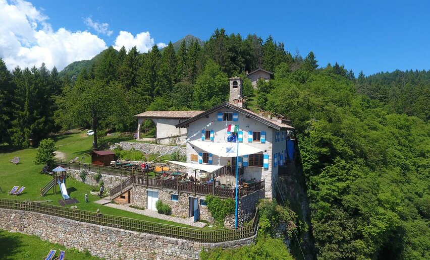
Once in Vespana, as guided by the route signage, keep right towards the locality of Treni where you will face another challenging climb. Take a pause at the cross of Bondiga to admire the breathtaking panorama. Then, with legs and lungs slightly refreshed continue your ascent through the forest road up to the Dosso della Vecchia. At this point the hard work is not yet over. However, the gradient becomes more undulating and forgiving as you head towards the town of San Giovanni al Monte. Here you will be pleased to find another fountain and a popular refreshment spot for cyclists: Malga San Giovanni. Continue to descend on the asphalt road, then a few hundred meters from the town, route 742 leads to the left.
For those of you wanting more of a challenge, follow the signage for route 425 - leading to a rather technical descent with a considerable gradient, and unstable terrain. When you reach the main road remember to stay on the righthand side, following it down to Mandrea. Where, a little way after you must keep left to take a mule track. Once again you reach the main road which you quickly leave again before the village of Padaro, by taking a narrow trail on the left. Skirting along a fence, you will face another uphill section. Here the terrain does nothing for one’s on-bike comfort, but it’s only the prelude to another challenging descent! The first part of which is rather exposed, becoming increasingly steep and technical.
Once you have identified the narrow trail (If in doubt look for the red and white painted symbols) its various crossroads in the woods are clearly indicated once again by the 742 route signage. Needless to say, ride according to your skills and please don’t take unnecessary risks. It is said that on the rocky sections it is better to walk, than to fall! At the exit of the trail, turn right following the road to the church of Santa Maria di Laghel. Continue to the right following the road until Arco, your original starting point.

, Garda Trentino")
, Garda Trentino")
, Garda Trentino")
, Garda Trentino")
, Garda Trentino")
, Garda Trentino")
, Garda Trentino")
, Garda Trentino")
, Garda Trentino")
, Garda Trentino")
, Garda Trentino")
, Garda Trentino")
, Garda Trentino")
, Garda Trentino")


, Garda Trentino")
, Garda Trentino")
, Garda Trentino")


, Garda Trentino")
, North Lake Garda Trentino")


, Garda Trentino")


