Logo Garda
Top

Monte Velo Trail-Tour

Torbole sul Garda - Nago, Val di Gresta, Arco, Surroundings
Category
Difficulty
Difficult
Duration
6:05
Duration in hours
Distance
41.5
Distance in km
Status
open
Suggested period
Jan
Feb
Mar
Apr
May
Jun
Jul
Aug
Sep
Oct
Nov
Dec

A circuit that has everything that goes to make up a great tour.

Signage: 760. Monte Velo Trail - Tour

Long climbs, entertaining descents, beautiful views and varying landscapes – and a great variant: all this awaits you on this circuit. From Arco, begin as for tour 759 via San Martino and Carobbi to Passo Due Sassi, then continue via Malga Zanga to Santa Barbara. A variant via the Maso Naranch Trail starts here, but should only be tackled by experts. The tour skirts around the west of Monte Creino, taking a series of beautiful trails to the Maso Naranch farmstead, which is a great place to stop for refreshments. From there you don’t ride straight down to Nago, you cross over instead into Val di Gresta, an agricultural valley famous for its organic farming. The varied descent to Loppio is on partly tarmacked, partly gravel cart tracks. You then take the cycle path to Nago and return easily to the starting point in Arco.

Variants: 760a. Variante Maso Naranch Trail


Further information and useful links

For more information on routes, bike services (rentals, workshops, shops) and cycling friendly accommodation: Garda Trentino - +39 0464 554444


Route info
Difficult
Route number
760
Distance
41,5 km
Duration
6 h 05 min
Altitude difference (+)
1.480 m
Altitude difference (-)
1.480 m
Technical skills
Physical effort
Scenary
Highest point
1.212 m
Lowest point
73 m
Suggestions

Don’t forget to take a break after Malga Fiavei: near a right-hand bend, a number of short paths branch off to the left through the forest to a series of First World War emplacements. These were built directly above mighty rocky outcrops and reward you with a wondrous view of Lake Garda and the surrounding mountains.

Safety guidelines

ITRS - International Trail Rating System

The ITRS is an objective way to assess trails and routes from a biker’s perspective, evaluating four aspects:

  • Technical Difficulty: riding skill level needed
  • Endurance: combined effect of length, uphill and downhill
  • Wilderness: amount of planning required based on mobile phone reception, rescue options, water supply and wildlife
  • Exposure: consequences of a fall

Discover more about the ITRS system and check the classification of this tour in the photo gallery.


Safety Tips

  1. Always wear your helmet.
  2. Plan your ride.
  3. You share the trail with other users. Yield right of way to hikers.
  4. Let your speed be determined by your experience.
  5. Ride slowly on crowded trails, overtake with politeness and respect.
  6. Cycle only on authorized and open trails.
  7. Avoid muddy trails in order not to damage them further.
  8. Respect public and private property.
  9. Always be self-sufficient.
  10. Do not cycle solo in remote areas.

This information is subject to inevitable variations, so none of these indications are absolute. It is not entirely possible to avoid giving inexact or imprecise information, given how quickly environmental and weather conditions can change. For this reason, we decline any responsibility for changes which the user may encounter. In any case, it is advisable to check environment and weather conditions before setting out.

Punto di partenza
Caneve (Arco)
Directions

The starting point of the tour is in Arco, along the cycling path next to the Caneve car park. Following the cycle path towards the town centre of Arco, we cross the river Sarca and ride northwards along it. We pass by the climbing stadium and cross the river once again. At the roundabout we cross the main road and reach the treelined street on the other side, which leads to the Convent of San Francesco.

Instead of going all the way to the convent, we turn left in Via di Sai and then right into Via Angelo Maino. At the crossroads near the car park we turn left and ride through the hamlet of San Martino passing by the church located on a high spot. Then we keep right and start our ascent on a rather narrow asphalt road in the direction of the Policromuro crag and the Bosco Caproni. Once we reach Pianaura, we come upon a fork and turn right to continue the climb towards Troiana, where the asphalt gives way to a dirt road, and Carobbi, a nice spot surrounded by beautiful chestnut groves. From here, make sure before heading straight at the junction for Braila to fill up with water at the spring near the house nearby.

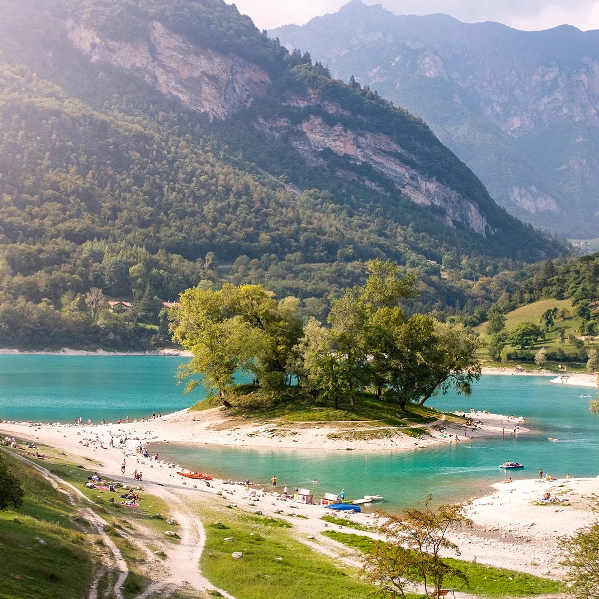
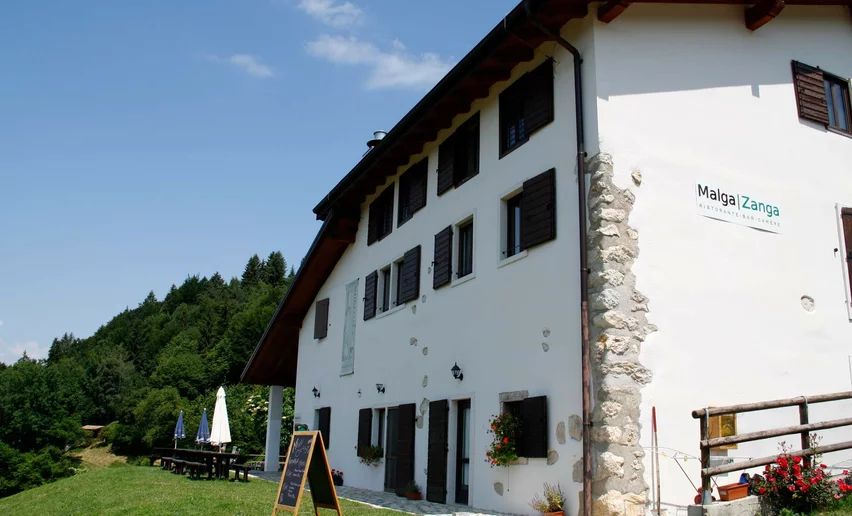
Now follow directions again and, after a short downhill stretch through the woods, you start climbing again towards Passo Due Sassi. On a clear day, this stretch of the route which takes you towards Malga Zanga, offers stunning views. Once you have passed the pastures, you need to make one final effort to get to the pass, Passo Santa Barbara. When you come to the stop sign at the pass, where you will also find a water fountain, keep to the right and follow the main road for a hundred metres or so. Follow directions and leave the road, keeping to the left, and you are back on a dirt track again. Now you come to the downhill run with the worst going which leads you down towards Malga Fiavei. When you come to a sharp bend to the right, which is on route 762, keep left and head towards Pannone. At the next junction keep on straight, still going downhill, and you will come to Maso Naranch and its marvellous views over Lake Garda.

Keep on going in the direction of Pannone and when you get near the shrine of San Rocco, you will find yourself back on a paved road again. Keep on straight until you come to the main road which goes up from Pannone to Passo Santa Barbara. Keep to the right here, heading down towards the nearby village and almost immediately, turn right. An old dirt road brings you back onto the main road near the ruins of Castel Gresta. From here on, continue downhill towards Loppio and the route will  take you off and back onto the main road repeatedly until you come to the cycle path which runs along the bottom of the valley. Turn right onto it in the direction of Lake Garda. When you reach the pass at Passo San Giovanni, follow directions for the bike trail towards Nago and ride through the historic centre. As you leave the town, you come to a roundabout where you turn left onto a steep downhill lane which runs through a car park. You are back on a dirt track again and when you come to the snack bar Sesto Grado, cross the main road for Torbole, continuing downhill in the direction of Arco. Once you get to the bottom, in sight of Arco Castle, follow directions and cross the peaceful farmland of Pratosaiano until you get back to where you started from.

public transportation

The main towns in Garda Trentino - Riva del Garda, Arco, Torbole sul Garda, Nago – are connected by several urban and intercity bus lines which will take you to the starting point of tours or in the immediate surroundings.

You can also get to Riva del Garda and Torbole sul Garda by the public ferry service.

Up-to-date information on timetables and routes.


How to get there
Where to park

Parking in Caneve (5 minutes walk to the town centre).

Paid parking: Foro Boario, near the bridge (Via Caproni Maini) or the post office (Via Monache).

Riding your bike requires specific clothing and equipment, even for relatively short and easy trips. It is always better to be prepared… e.g. for bad weather or a sudden drop in your energy levels. The unexpected things are part of the fun!

Remember to thoroughly evaluate the type of route you plan on doing, the locations you intend to cross and the current season. Has it been raining? Attention: The paths may be slippery and require more caution.

What do I need to bring on my bike tour?

  • An adequate water supply according to your needs (considering temperature, possibility of refuelling and duration of the route)
  • Plenty of snacks (for example, dried fruit or energy bars)
  • Waterproof / Windproof jacket
  • A spare top / spare socks (Descending in a sweaty garment, will make you cold).
  • Suncream
  • Sunglasses
  • Bike gloves/mitts
  • Map or GPS device
  • Bike lights: best placed on your helmet or handlebars. (It is always best to be prepared)
  • Bike repair kit for punctures and mechanical breakdowns
  • First aid kit
  • Emergency whistle

It is always advised to let someone know where you plan to go and how long you expect to be.

Emergency telephone number 112.

Arco
E-Bike Stop Malga Zanga - Monte Velo
bike stop
Arco
E-Bike Stop Info Point Arco
bike stop
Arco
E-Bike Stop Parking Caneve - Arco
bike stop
Torbole sul Garda - Nago
E-Bike Stop Parking Coel - Nago
bike stop
Arco
E-Bike Stop Parking Carmellini - Arco
bike stop
Arco
E-Bike Stop Bicigrill Moletta - Arco
bike stop
Arco
Malga Zanga
outdoor specialist
You might be interested in
Discover related tours
Tiarno di Sotto in Spring | © Archivio Garda Trentino (ph. Renzo Mazzola), Garda Trentino
Intermediate
Ledro
Bocca Giumella Trail - Tour
Distance 17,2 km
Duration 3 h 30 min
Altitude difference (+) 840 m
Altitude difference (-) 840 m
Status
open
Piazza III Novembre in Riva del Garda | © Archivio Garda Trentino (ph. Watchsome), Garda Trentino
Intermediate
Riva del Garda, Ledro
From Lake Garda to Lake Ledro via Ponale
Distance 32,4 km
Duration 3 h 00 min
Altitude difference (+) 650 m
Altitude difference (-) 650 m
Status
closed
View over Lake Ledro from the Monte dei Pini Trail - Tour | © Archivio Garda Trentino (ph. Max Spagnolli), North Lake Garda Trentino
Intermediate
Ledro
Monte dei Pini Trail - Tour
Distance 7,0 km
Duration 2 h 00 min
Altitude difference (+) 510 m
Altitude difference (-) 510 m
Status
open
Biking along the shores of Lake Lamar | © Archivio Garda Trentino (ph. Tommaso Prugnola), Garda Trentino
Intermediate
Valle dei Laghi
Variante Terlago
Distance 21,1 km
Duration 3 h 00 min
Altitude difference (+) 720 m
Altitude difference (-) 720 m
Status
open
© Archivio APT Garda Dolomiti - Castagna, Garda Trentino
Intermediate
Tenno, Arco, Riva del Garda
2024 Bike Marathon Garda Trentino Ronda Piccola
Distance 30,6 km
Duration 5 h 00 min
Altitude difference (+) 1.065 m
Altitude difference (-) 1.065 m
Status
open
Lago di Valagola in the Adamello Brenta Nature Park | © Archivio Garda Trentino (ph. Ronny Kiaulehn), Garda Trentino
Difficult
Comano
Dolomiti Movlina - Tour
Distance 75,2 km
Duration 8 h 00 min
Altitude difference (+) 1.950 m
Altitude difference (-) 1.950 m
Status
closed