Logo Garda
Top

Cavedine Gravel Experience

Dro & Drena, Valle dei Laghi, Arco
Category
Difficulty
Intermediate
Duration
4:25
Duration in hours
Distance
45
Distance in km
Status
open
Suggested period
Jan
Feb
Mar
Apr
May
Jun
Jul
Aug
Sep
Oct
Nov
Dec

A gravel bike trip in the Cavedine and Sarca valleys

Arco is easy to get to from the surrounding towns, using the handy cycle paths. From here, the climb is rapid, in a setting of olives and holm oaks, alongside the cliffs that have made climbing in this area so famous. Passing from the village of Braila, the route continues towards Drena before entering the Val di Cavedine, at the foot of Mount Bondone. The most difficult section is when coming to the top, towards the Sarca Valley, along the route through the archaeological area of Cavedine. The rather uneven surface here includes old cobbles and makes some of the sections anything but predictable. After this section, the surfaces are once again smooth as far as Lake Cavedine and therefore, the bottom of the valley.

Further information and useful links
It is quite difficult to identify the suggested route without using a navigation system to follow the gpx track provided.

For more information on routes, bike services (rentals, workshops, shops) and cycling friendly accommodation: Garda Trentino - +39 0464 554444


Route info
Intermediate
Route number
Distance
45,0 km
Duration
4 h 25 min
Altitude difference (+)
901 m
Altitude difference (-)
912 m
Technical skills
Physical effort
Scenary
Highest point
658 m
Lowest point
84 m
Suggestions

There are some noteworthy archaeological sites to see along the route, and in particular: rock engravings in Pianaura, and the Carega del Diaol on the hill overlooking Cavedine.

Safety guidelines
It is quite difficult to identify the suggested route without using a navigation system to follow the gpx track provided.

Safety Tips

  1. Always wear your helmet.
  2. Plan your ride.
  3. Obey the road signs, stop at traffic lights and do not ride on the wrong side of the road.
  4. You share the trail with other users. Yield right of way to hikers.
  5. Respect public and private property.
  6. Do not cycle solo in remote areas.
  7. Make sure your bike lights are working.


This information is subject to inevitable variations, so none of these indications are absolute. It is not entirely possible to avoid giving inexact or imprecise information, given how quickly environmental and weather conditions can change. For this reason, we decline any responsibility for changes which the user may encounter. In any case, it is advisable to check environment and weather conditions before setting out.

Punto di partenza
Arco
Directions

Once out of the car park at Caneve, keep left along the road then take the first right. Follow the Via del Rì until you pass the flyover. Keep on the left, carrying on straight until you come to a house. Then turn right, alongside the wall on the dirt track. Continue straight along this track until you come to the road that will take you to the church in the centre of Bolognano. Now turn left past the church and continuing on your left, the route will take you through the houses along Via Pasubio and Via Della Repubblica, as far as a small square with a fountain and a small children’s playground.

Take the right onto Via Gambor. Following this road, past an old church, you now begin a climb, taking the right at the next fork, followed by the left and then the right again. Now leave the asphalt road for a small track to the left that will take you down in the direction of Massone. At the end of the descent, keep to the right as far as the first houses in the village. Now take the very first right, along a narrow road through the houses in the direction of the church of San Martino. Once past the church, keep right at the fork and continue up towards the chestnut wood of Pianaura. Now follow the signs to Braila. At the first fork, continue straight ahead, while at the second, which is marked by a crucifix, leave the main road, keeping to the right. Cross through Braila to continue on the asphalt road at the end of the village. After several steep downhill bends, you will come to the road you left previously; keep right. After a few hundred metres, you will come to the Open Air Gallery. Now take the dirt road on the right to the end. Now you will come to another asphalt section near the La Casina restaurant. Stay on the left and then continue straight along Via dei Vespiai until you finally come to Val di Cavedine.

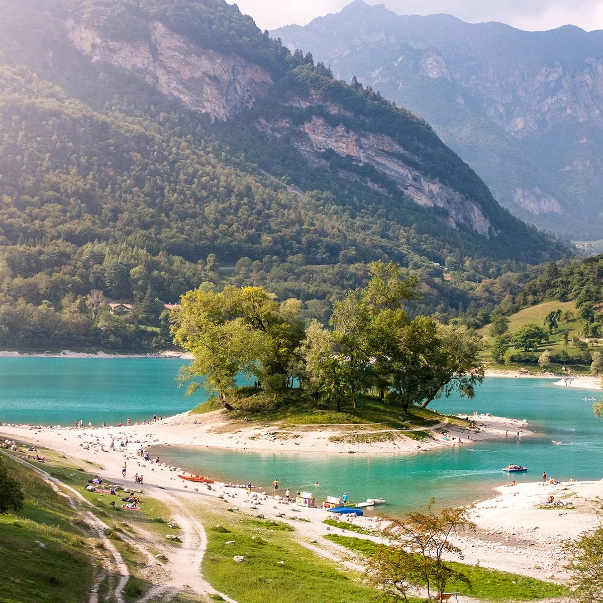
Once on the road to Malga Campo, keep on the left and then leave the road on the first right, following the signs for the MTB route through the vineyards. Once at a crossroads close to the provincial road, follow the signs for route 1720 which will take you up towards Masi di Vigo. Once past the pizzeria, continue straight on as far as the crossroads to Via Masi di Sopra. Now turn left along the road that will take us straight to Vigo Cavedine. Once through this village, continue along Via Capitello then turn right into Via dei Filari. Continue straight ahead towards the centre of Cavedine, then turn left again, following the signs for route 1720. Now cross the state road towards Piazza Italia, then continue along Via Ospedale and then Via Diaz. Once past the church, leave the town and keep to the left to the top of the hill past Dosso di San Lorenzo. Just past a column capital, take the track on the right for the archaeological route. This will take you into a network of paths with some rather uneven surface sections. Follow the signs for routes 1800 and 753, which meet on this section of your route, to take you up to the top of the hill and into the Sarca Valley. Exit on Via San Siro, keeping to the left to start your descent on asphalt road. At the third rightwards bend, take a little road on the left, alongside Lake Cavedine.

Once on the Via Piné, continue down to the bottom of the valley and in the direction of the lake. Take the right past over the stream you are riding alongside, close to its mouth. Then take the first left onto the cycle path that will take you to Dro. Cross the village and take Via Cesare Battisti over the River Sarca. Just after the bridge, keep to the left, turning onto a dirt track that will take you to the Roman bridge in Ceniga. Carrying straight on from here will take you to the starting point, following the cycle track in the last section.

public transportation

The main towns in Garda Trentino - Riva del Garda, Arco, Torbole sul Garda, Nago – are connected by several urban and intercity bus lines which will take you to the starting point of tours or in the immediate surroundings.

You can also get to Riva del Garda and Torbole sul Garda by the public ferry service.

Up-to-date information on timetables and routes.


How to get there

A22 motorway, exit: Rovereto Sud - Lake Garda. Then SS240 in the direction of Riva del Garda - Arco. 

Find out how to reach Garda Trentino.


Where to park

Parking in Caneve (5 minutes walk to the town centre).

Paid parking: Foro Boario, near the bridge (Via Caproni Maini) or the post office (Via Monache).

Riding your bike requires specific clothing and equipment, even for relatively short and easy trips. It is always better to be prepared… e.g. for bad weather or a sudden drop in your energy levels. The unexpected things are part of the fun!

Remember to thoroughly evaluate the type of route you plan on doing, the locations you intend to cross and the current season. Has it been raining? Attention: The paths may be slippery and require more caution.

What do I need to bring on my bike tour?

  • An adequate water supply according to your needs (considering temperature, possibility of refuelling and duration of the route)
  • Plenty of snacks (for example, dried fruit or energy bars)
  • Waterproof / Windproof jacket
  • A spare top / spare socks (Descending in a sweaty garment, will make you cold).
  • Suncream
  • Sunglasses
  • Bike gloves/mitts
  • Map or GPS device
  • Bike lights: best placed on your helmet or handlebars. (It is always best to be prepared)
  • Bike repair kit for punctures and mechanical breakdowns
  • First aid kit
  • Emergency whistle


It is always advised to let someone know where you plan to go and how long you expect to be.

Emergency telephone number 112.

You might be interested in
Discover related tours
Nosiola vineyards | © Archivio Garda Trentino (ph. Watchsome), Garda Trentino
Easy
Valle dei Laghi
Divin Nosiola Gravel Experience
Distance 25,4 km
Duration 3 h 15 min
Altitude difference (+) 584 m
Altitude difference (-) 550 m
Status
open
© Archivio APT Garda Dolomiti - Castagna, Garda Trentino
Difficult
Riva del Garda, Comano, Valle dei Laghi, Arco, Dro & Drena, Torbole sul Garda - Nago, Tenno
Maxxis Gravel Garda Trentino - Long Track
Distance 102,8 km
Duration 6 h 30 min
Altitude difference (+) 1.661 m
Altitude difference (-) 1.672 m
Status
open
© Luca bortolotti, Garda Trentino
Difficult
Valle dei Laghi, Comano
Terlago-Banale Gravel Experience
Distance 64,1 km
Duration 7 h 05 min
Altitude difference (+) 1.658 m
Altitude difference (-) 1.662 m
Status
open
© Marco Giacomello, Garda Trentino
Difficult
Riva del Garda, Comano, Arco, Dro & Drena, Torbole sul Garda - Nago, Valle dei Laghi, Tenno
Comano Gravel Experience
Distance 68,8 km
Duration 6 h 15 min
Altitude difference (+) 1.105 m
Altitude difference (-) 1.107 m
Status
open
In the fields near Cornelle | © Archivio Garda Trentino (ph. Tommaso Prugnola), Garda Trentino
Intermediate
Comano
Km0 UNESCO Comano Gravel Experience
Distance 39,6 km
Duration 3 h 40 min
Altitude difference (+) 879 m
Altitude difference (-) 874 m
Status
open
Lakeside vineyards in Pur | © Archivio Garda Trentino (ph. Watchsome), North Lake Garda Trentino
Easy
Ledro
Ledro Gravel Experience
Distance 41,9 km
Duration 3 h 15 min
Altitude difference (+) 475 m
Altitude difference (-) 475 m
Status
closed