aria.quick_link.navi aria.quick_link.skiptomaincontent aria.quick_link.footer
Garda Trentino Logo
Top

Summit Tour

Tenno, Ledro, Comano, Riva del Garda

Category
Difficulty
Difficult
Duration
11:00
Duration in hours
Distance
25.8
Distance in km
Status
open
Suggested period
Jan
Feb
Mar
Apr
May
Jun
Jul
Aug
Sep
Oct
Nov
Dec

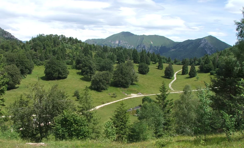
Pichea, Tofino, Doss de la Torta, Gavardina, Corno dei Guì, Corno di Lomar, Roda, Cadria. In Valle di Ledro, if someone talks about the ‘Giro delle cime’ (i.e. Tour of the Mountain Tops), these are the mountains that come to mind, the highest in the valley.

Very demanding route along the mountain tops which surround Val Concei like a crown. Above 2000 m all vegetation gives way to grassland and the eye is free to roam around. To the West is the Adamello, to the North the Brenta group, whereas Valle di Ledro unfolds to the South. Breathtaking landscapes for an unforgettable experience.

Further information and useful links

For more information on routes, services (guides, mountain huts, shops etc.) and hiking friendly accommodation: Garda Trentino - +39 0464 554444

details
  • Scenic
  • Summit route
  • Round trip
  • Exposed sections
  • Secured passages
  • Ridge
Route info
Difficult
Route number
Distance
25,8 km
Duration
11 h 00 min
Altitude difference (+)
2.488 m
Altitude difference (-)
2.488 m
Physical effort
Scenary
Highest point
2.240 m
Lowest point
833 m
Suggestions

The best time to do this tour is on clear days, so as to enjoy the views to the fullest! Each mountain has its story and its identity. Mount Cadria, with its 2.254 m, is the highest mountain in Valle di Ledro. According to local legends Mount Gavardina is home to an enchanted being who watches over the valley, a fairy called Gavardina.

You might be interested in
Discover related tours
Ca' de Mez | © Staff Outdoor Garda Trentino AC, Garda Trentino
Difficult
Ledro
Tour of the malghe of Molina
Distance 13,8 km
Duration 6 h 00 min
Altitude difference (+) 1.286 m
Altitude difference (-) 1.288 m
Status
open
View over Lake Garda from the trenches of Monte Corno | © Associazione 1 Territorio 2 Fronti, Garda Trentino
Easy
Torbole sul Garda - Nago
WWI: Monte Corno and Busa dei Capitani
Distance 3,4 km
Duration 1 h 45 min
Altitude difference (+) 317 m
Altitude difference (-) 316 m
Status
open
View towards Monte Carone | © Staff Outdoor Garda Trentino AC, Garda Trentino
Difficult
Ledro
Ledro Alps Trek Alpiedi - Leg 2: from Tremalzo to Bivacco Arcioni
Distance 23,7 km
Duration 8 h 00 min
Altitude difference (+) 1.138 m
Altitude difference (-) 2.021 m
Status
open
© Renata Fedrizzi, Garda Trentino
Difficult
Comano
Malga Nardis
Distance 15,3 km
Duration 7 h 00 min
Altitude difference (+) 1.230 m
Altitude difference (-) 1.222 m
Status
open
Ponale | © Archivio APT Garda Dolomiti - Watchsome, Garda Trentino
Easy
Riva del Garda, Ledro
Ponale Path (from Riva del Garda)
Distance 6,4 km
Duration 3 h 00 min
Altitude difference (+) 736 m
Altitude difference (-) 272 m
Status
open
Lake Ledro from Dromaè | © Alice Russolo, Garda Trentino
Intermediate
Riva del Garda, Ledro
Dromaé - Cima d'Oro
Distance 11,5 km
Duration 6 h 00 min
Altitude difference (+) 1.128 m
Altitude difference (-) 1.128 m
Status
open