
A mountain biking adventure that can be tackled by inexperienced riders. Variant of the 756. San Udalrico - Tour.
Signage: 756a. Variante San Siro
The Passo Udalrico tour, which is not overly long, can be extended by just under 9 km towards San Siro chapel. The longer section at the beginning is especially interesting, where you can glide along very easily on narrow tracks and bridle paths without much climbing or descending.
, Garda Trentino")
, Garda Trentino")
, Garda Trentino")
The texts relating to the route described in this sheet have been produced by Marco Giacomello, mountain bike guide.
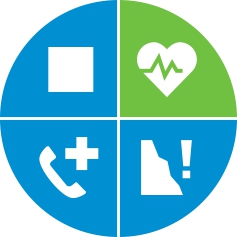
For more information on routes, bike services (rentals, workshops, shops) and cycling friendly accommodation: Garda Trentino - +39 0464 554444.
ITRS - International Trail Rating System
The ITRS is an objective way to assess trails and routes from a biker’s perspective, evaluating four aspects:
Discover more about the ITRS system and check the classification of this tour in the photo gallery.
Safety Tips
This information is subject to inevitable variations, so none of these indications are absolute. It is not entirely possible to avoid giving inexact or imprecise information, given how quickly environmental and weather conditions can change. For this reason, we decline any responsibility for changes which the user may encounter. In any case, it is advisable to check environment and weather conditions before setting out.
The starting point of the route is in Trebi. Coming north from Dro you will find the first sign for route 753 to your right, at the forked road. However, starting from the south of the lake, continue south for a few dozen meters where you should take the first road on your left. Here you will quickly find the route signage which guides you uphill, through the locality of Trebi. Continue to climb on the main road, where the gradient is constant at around 10%. Quickly gaining altitude, you’ll have the possibility to admire the remarkable views of Lake Cavedine and the Sarca Valley.
A little after you have passed over the hill-top, follow a wide curve round to the right. Leave the asphalt road, and take the archeological gravel road, continuing to follow the directions for route 753. All of the turnings are well indicated and the route continues with undulating terrain until the locality of San Siro. Once again riding on asphalt, keep left and start to descend, following the main road - as indicated by the signage.
At the fourth hairpin bend, take the gravel road on the left that brings you back to Lake Cavedine. After approximately 100 meters, the terrain returns to asphalt. Continue to follow the road downhill toward the lake, where you will rapidly meet its tributary.
Turn left here and follow the road that runs along the water course to the south, where for a short time you will arrive at the lake itself. Continue straight on to find the route starting point.
Cavedine is connected by the intercity bus lines (204, 205). For up-to-the-minute information on timetables and routes
Parking at the starting point of the 756. San Udalrico Tour.
Riding your bike requires specific clothing and equipment, even for relatively short and easy trips. It is always better to be prepared… e.g. for bad weather or a sudden drop in your energy levels. The unexpected things are part of the fun!
Remember to thoroughly evaluate the type of route you plan on doing, the locations you intend to cross and the current season. Has it been raining? Attention: The paths may be slippery and require more caution.
What do I need to bring on my bike tour?
It is always advised to let someone know where you plan to go and how long you expect to be.
Emergency telephone number 112.


 | © Archivio APT Garda Trentino (ph. Vuilleumier) , Garda Trentino")
, North Lake Garda Trentino")
, Garda Trentino")

, Garda Trentino")
, North Lake Garda Trentino")


