Logo Garda
Top

Ronda Extrema

Arco, Comano, Dro & Drena, Riva del Garda, Tenno
Category
Difficulty
Difficult
Duration
8:00
Duration in hours
Distance
88.8
Distance in km
Status
open
Suggested period
Jan
Feb
Mar
Apr
May
Jun
Jul
Aug
Sep
Oct
Nov
Dec

In the beginning the former “Ronda extrema” has the same trail like the “Ronda grande” through the Val Lomasone to Malga di Vigo, but from Sentiero dei Russi it leads first on an apparently unending trail almost 1,000 meters difference in altitude really powerfully downhill to Comano. Then another, energy sapping uphill awaits you towards Monte Casale – before the peak again quite new, magical forest trails come up towards Malga Valbona and from Prati del Granzoline at almost 1,400 meters difference in altitude and then it's time again for … the fine forest trails and meadow trails always alternating with the spectacular panorama views of the Dolomiti di Brenta. Back to Riva the route leads again on the same downhill like the two smaller rounds.

 We are working for you!

We are currently working on maintenance and signposting on this trail. While work is under way, we might find better variants: for this reason there might be slight difference between the trail description and the actual itinerary. We will fix this as soon as we finish the work. We are currently revising description and details of the tour as well. Thanks for your patience!

Further information and useful links
Route info
Difficult
Route number
773
Distance
88,8 km
Duration
8 h 00 min
Altitude difference (+)
4.199 m
Altitude difference (-)
4.162 m
Technical skills
Physical effort
Scenary
Highest point
1.484 m
Lowest point
65 m
Safety guidelines

Safety Tips

  • Always wear your helmet.
  • Plan your ride.
  • You share the trail with other users. Yield right of way to hikers.
  • Let your speed be determined by your experience.
  • Ride slowly on crowded trails, overtake with politeness and respect.
  • Cycle only on authorized and open trails.
  • Avoid muddy trails in order not to damage them further.
  • Respect public and private property.
  • Always be self-sufficient.
  • Do not cycle solo in remote areas.

This information is subject to inevitable variations, so none of these indications are absolute. It is not entirely possible to avoid giving inexact or imprecise information, given how quickly environmental and weather conditions can change. For this reason, we decline any responsibility for changes which the user may encounter. In any case, it is advisable to check environment and weather conditions before setting out.

Punto di partenza
Riva del Garda
public transportation

The main towns in Garda Trentino - Riva del Garda, Arco, Torbole sul Garda, Nago – are connected by several urban and intercity bus lines which will take you to the starting point of tours or in the immediate surroundings.

You can also get to Riva del Garda and Torbole sul Garda by the public ferry service.

Up-to-date information on timetables and routes.


How to get there
Where to park

Parking near the former hospital (Via Rosmini) or the former cemetery (Viale Damiano Chiesa).

Paid parking: Terme Romane (Viale Roma), Vecchia stazione (Largo Medaglie d’Oro), Ex-agraria (Via Lutti), Area ex-Cattoi (Viale Rovereto).

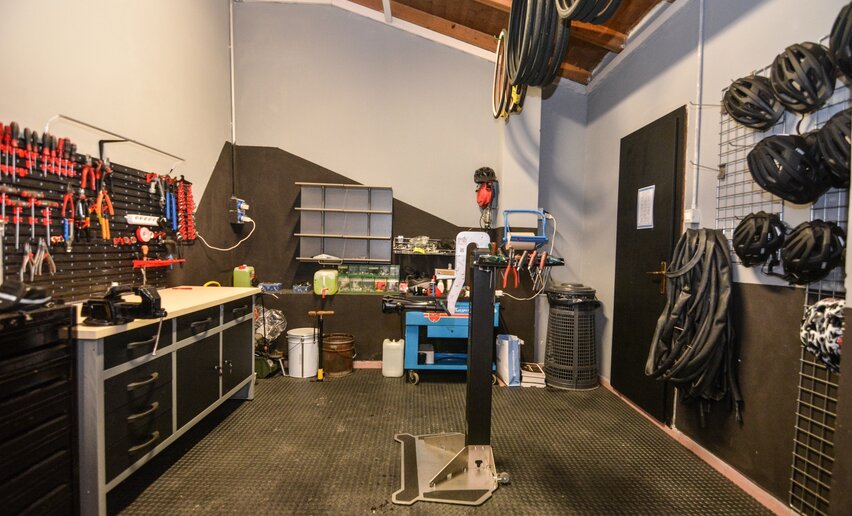
Riding your bike requires specific clothing and equipment, even for relatively short and easy trips. It is always better to be prepared… e.g. for bad weather or a sudden drop in your energy levels. The unexpected things are part of the fun!

Remember to thoroughly evaluate the type of route you plan on doing, the locations you intend to cross and the current season. Has it been raining? Attention: The paths may be slippery and require more caution.

What do I need to bring on my bike tour?

  • An adequate water supply according to your needs (considering temperature, possibility of refuelling and duration of the route)
  • Plenty of snacks (for example, dried fruit or energy bars)
  • Waterproof / Windproof jacket
  • A spare top / spare socks (Descending in a sweaty garment, will make you cold).
  • Suncream
  • Sunglasses
  • Bike gloves/mitts
  • Map or GPS device
  • Bike lights: best placed on your helmet or handlebars. (It is always best to be prepared)
  • Bike repair kit for punctures and mechanical breakdowns
  • First aid kit
  • Emergency whistle

It is always advised to let someone know where you plan to go and how long you expect to be.

Emergency telephone number 112.

Arco
E-Bike Stop Malga S. Giovanni - Arco
bike stop
Riva del Garda
E-Bike Stop Info Point Riva del Garda
bike stop
Riva del Garda
E-Bike Stop Punta Lido - Riva del Garda
bike stop
Tenno
Bike Stop Parking Tenno
bike stop
Torbole sul Garda - Nago
Carpentari Cycling Stories
open
closed
services
Riva del Garda
Cicli Pederzolli
open
closed
bike shop
Riva del Garda
Degasperi rent e-bike
open
closed
bike shop
Riva del Garda
E-BIKEGARDA
open
closed
bike shop
Riva del Garda
Energiabike
open
closed
bike shop
Torbole sul Garda - Nago
Mandelli Bike
open
closed
bike shop
Riva del Garda
Rosà Bike
open
closed
services
Riva del Garda
The Lab
open
closed
bike shop
Torbole sul Garda - Nago
Velolake
open
closed
services
Torbole sul Garda - Nago
Garda Bike Shuttle
always open
services
Arco
Moser Sport Arco
open
closed
bike shop
You might be interested in
Discover related tours
Tiarno di Sotto in Spring | © Archivio Garda Trentino (ph. Renzo Mazzola), Garda Trentino
Intermediate
Ledro
Bocca Giumella Trail - Tour
Distance 17,2 km
Duration 3 h 30 min
Altitude difference (+) 840 m
Altitude difference (-) 840 m
Status
open
Lago di Cavedine | © Archivio Garda Trentino (ph. Watchsome), Garda Trentino
Easy
Valle dei Laghi, Dro & Drena
Cavedine Shortcut
Distance 7,1 km
Duration 40 min
Altitude difference (+) 50 m
Altitude difference (-) 50 m
Malga Giù | © Archivio Garda Trentino, Garda Trentino
Intermediate
Ledro
Variante Caset Pubregn - Trail
Distance 12,3 km
Duration 2 h 00 min
Altitude difference (+) 230 m
Altitude difference (-) 1.080 m
Status
open
Piazza III Novembre in Riva del Garda | © Archivio Garda Trentino (ph. Watchsome), Garda Trentino
Intermediate
Riva del Garda, Ledro
From Lake Garda to Lake Ledro via Ponale
Distance 32,4 km
Duration 3 h 00 min
Altitude difference (+) 650 m
Altitude difference (-) 650 m
Status
closed
Prati di Guil | © Hartmut Wimmer, Outdooractive Premium
Intermediate
Ledro
Variante Leano
Distance 5,6 km
Duration 45 min
Altitude difference (+) 5 m
Altitude difference (-) 741 m
Status
open
View over Lake Ledro from the Monte dei Pini Trail - Tour | © Archivio Garda Trentino (ph. Max Spagnolli), North Lake Garda Trentino
Intermediate
Ledro
Monte dei Pini Trail - Tour
Distance 7,0 km
Duration 2 h 00 min
Altitude difference (+) 510 m
Altitude difference (-) 510 m
Status
open