Logo Garda
Top

From Malga Campo to Rifugio Altissimo above Lake Garda

Torbole sul Garda - Nago
Category
Difficulty
Intermediate
Duration
3:35
Duration in hours
Distance
9.4
Distance in km
Status
open
WSEN
Suggested period
Jan
Feb
Mar
Apr
May
Jun
Jul
Aug
Sep
Oct
Nov
Dec

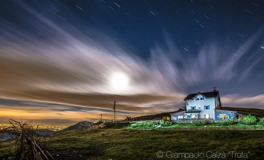
The mountain hut Rifugio Damiano Chiesa on Monte Altissimo is one of the most popular destinations with hikers in Garda Trentino. This is a variation on the usual route for you to try

This hike gives you the chance to explore the face of Monte Baldo where the hut Rifugio Damiano Chiesa is situated. The area is extremely popular with hikers who can enjoy the local flora, spectacular panoramas and finally wind up with some hearty local food when they get to the hut.

This trek is through the Monte Baldo Local Nature Reserve, a protected area notable for its exceptional biodiversity. Monte Baldo has been renowned for its extraordinary variety of plants and flowers since the 15th century when it was known as the “Garden of Europe”

All around the mountain hut Rifugio Damiano Chiesa there are still remains of tunnels and trenches dating back to the Great War. This outpost was taken by the Italian army without any bloodshed in the early stages of the war and became the front line of the Italian Front and an important observation point over the Alto Garda area

Further information and useful links

For more information on routes, services (guides, mountain huts, shops etc.) and hiking friendly accommodation: Garda Trentino - +39 0464 554444


Route info
Intermediate
Route number
Distance
9,4 km
Duration
3 h 35 min
Altitude difference (+)
508 m
Altitude difference (-)
508 m
Technical skills
Physical effort
Scenary
Highest point
2.051 m
Lowest point
1.609 m
Suggestions

Do not miss the occasion to taste the typical food of the Rifugio D. Chiesa on the top of Monte Altissimo!

The Monte Baldo Local Nature Reserve has many hiking trails with panels providing information about the particular features of the park. A list can be found on the reserve website

The trail SAT 601 is part of the Sentiero della Pace (or Peace Trail), a long distance trail which links the most important points along the Front during the First World War in Trentino. 


Safety guidelines

Safety Tips

  1. Choose itineraries that suit your physical and technical abilities. Collect information about the area you are visiting and the trail’s conditions and get a detailed trekking map.
  2. Wear clothes and take equipment that suit the difficulty and length of your tour. Keep emergency gear in your rucksack, including first aid supplies.
  3. Do not go walking alone in the mountains. In any case, tell someone where you are going and report back on returning.
  4. Look at the weather forecast before setting off and always keep an eye on the weather.
  5. In case of doubt, go back. It is better to give up than risk bad weather or face difficulties beyond your strength, ability and equipment.
  6. Do not leave marked paths and do not take shortcuts.
  7. All described walks are in a natural environment and therefore their use is at your own risk.

This information is subject to inevitable variations, so none of these indications are absolute. It is not entirely possible to avoid giving inexact or imprecise information, given how quickly environmental and weather conditions can change. For this reason, we decline any responsibility for changes which the user may encounter. In any case, it is advisable to check environment and weather conditions before setting out.

Punto di partenza
Cark park next to alpine hut Graziani
Directions

From the car park at the mountain hut Rifugio Graziani take the trail SAT 650 in the direction of Malga Campo. Shortly before the pasture, turn left onto SAT 622 as far as Bocca Paltrane. Here the trail starts to climb again until it joins SAT 601 which leads up along the ridge to the mountain hut Rifugio D. Chiesa. For the descent, follow SAT 633 back to where you started from. 

public transportation

To reach the start of the route, take the bus line B305 (Rovereto-Mori-Brentonico-Saccone) with bus stop in Brentonico. Up-to-date information on timetables and routes

To reach Rifugio Graziani, the Monte Baldo Nature Park shuttle bus service is available in summer. Click here for more information.

How to get there

From Mori follow directions for Brentonico, then San Giacomo and San Valentino. From there, take the main road in the direction of Monte Baldo/Rifugio Graziani.

Find out how to reach Garda Trentino.


Where to park

Free car parking near Rifugio Graziani.

You need to wear the right clothing and take the proper gear when you go hiking in the mountains. Even on relatively short easy outings make sure to take all you need so you don't run into trouble if things take an unexpected turn, for example a storm blows up or you have a sudden drop in energy levels.

What should you take when you go on a hike?

Your rucksack (for a day trip a 25/30L capacity should do) should contain:

  • water canteen (1L)
  • snacks (e.g. mixed dried fruit or chocolate)
  • First aid kit
  • windproof jacket
  • fleece
  • change of t-shirt and socks (in a plastic bag)
  • make sure to wear or at least bring a pair of long trousers
  • hat
  • sun screen
  • sunglasses
  • gloves
  • whistle to attract attention in an emergency


Make sure you're wearing the right footwear for the trail and season. The going can get rough and rocky underfoot and a pair of hiking boots will protect you from sprains. When wet, a grassy slope, rocky slab or steep trail can be dangerous unless you are wearing the proper footwear.

And finally... don't forget to bring your camera! You'll need it to capture the stunning views you come across all over Garda Trentino. And if you like, you can share your memories with us at #GardaTrentino.

Emergency telephone number 112.

Surroundings
Rifugio Altissimo Damiano Chiesa
open
closed
restaurants
You might be interested in
Discover related tours
View from Segrom | © Archivio APT Garda Trentino, North Lake Garda Trentino
Intermediate
Torbole sul Garda - Nago
23. The Great War: along the Segrom ridge to Malga Zures
Distance 5,1 km
Duration 2 h 30 min
Altitude difference (+) 451 m
Altitude difference (-) 451 m
Status
open
Bunker from WWII - Dos Tenim (Nago - Torbole) | © Staff Outdoor GardaTrentino MM, Garda Trentino
Intermediate
Torbole sul Garda - Nago, Arco, Riva del Garda
The "Blue Line" of Garda Trentino
Distance 15,2 km
Duration 5 h 20 min
Altitude difference (+) 291 m
Altitude difference (-) 293 m
Status
open
Monte Colodri | © Archivio Garda Trentino (Ph. Promovideo), Garda Trentino
Intermediate
Arco, Dro & Drena
Monte Colodri - Colt
Distance 10,0 km
Duration 4 h 00 min
Altitude difference (+) 415 m
Altitude difference (-) 411 m
Status
open
© Staff Outdoor Garda Trentino AC, Garda Trentino
Intermediate
Ledro
Bocca de l'Ussol
Distance 9,1 km
Duration 4 h 30 min
Altitude difference (+) 889 m
Altitude difference (-) 890 m
Status
closed
Monte Stivo | © Archivio Garda Trentino - (Ph. Jennifer Doohan), Garda Trentino
Intermediate
Val di Gresta, Arco
Monte Stivo
Distance 9,7 km
Duration 4 h 00 min
Altitude difference (+) 850 m
Altitude difference (-) 856 m
Status
open
Bondiga | © Archivio APT Garda Trentino (Ph. A. Seneci), North Lake Garda Trentino
Difficult
Arco, Dro & Drena, Tenno
GardaTrek - Medium Loop 2: from the Rifugio San Pietro hut to Ceniga
Distance 12,9 km
Duration 6 h 20 min
Altitude difference (+) 950 m
Altitude difference (-) 1.802 m
Status
open