
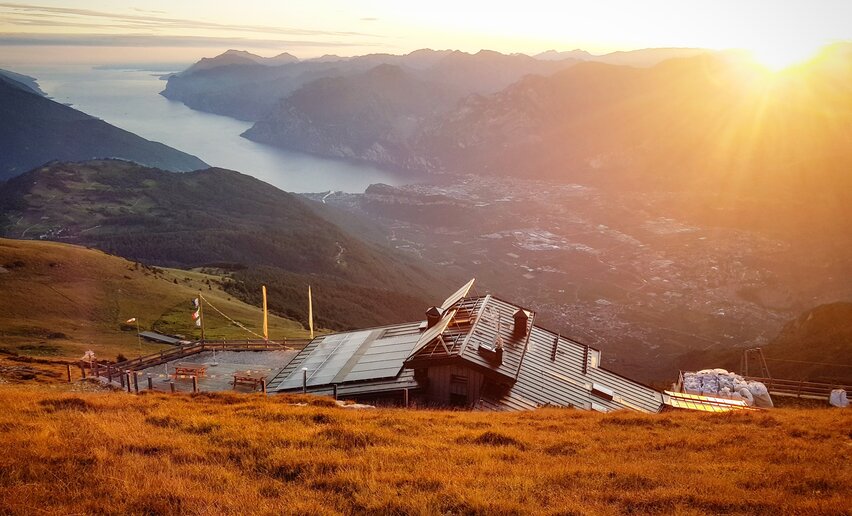
A breathtaking descent from the over 2000 metres a.s.l. of the pastures of Monte Stivo to Nago in the valley floor, across the former front of teh Great War
This stage takes you from 2000 metres on Monte Stivo to 220 metres in Nago and passes through a landscape which changes continually as you lose altitude, from alpine pasture to woodland and finally the olive groves and Mediterranean vegetation above the shores of Lake Garda.
A landscape which carries the signs of its past. When you are hiking on the trail SAT 637 near the Nago chestnut woods, you are on what used to be the Austrian Front Line during the Great War. Here local associations have restored the trenches and barricades in a number of areas and they are well worth a visit. You will discover a whole village hidden in the trees, with a lot of buildings and lookout points that will reward you with incredible views over northen lake Garda.
You can close your adventure on the Top Loop in Nago or rest before facing the next, challenging stage which will take you up to Monte Altissimo.

, Garda Trentino")
, Garda Trentino")

For those who prefer to finish the hike in Nago: you can continue on foot on the old Santa Lucia road in the direction of Torbole and from there to Riva del Garda on the cycle path along the lake shore; otherwise, Nago is well served by public transport (Info and bus times).
For more information on routes, services (guides, mountain huts, shops etc.) and hiking friendly accommodation: Garda Trentino - +39 0464 554444
Safety Tips
This information is subject to inevitable variations, so none of these indications are absolute. It is not entirely possible to avoid giving inexact or imprecise information, given how quickly environmental and weather conditions can change. For this reason, we decline any responsibility for changes which the user may encounter. In any case, it is advisable to check environment and weather conditions before setting out.
Head down from the mountain hut Rifugio Marchetti on trail SAT 608. Before you enter the woods at the other side of the meadows at the “Prese” turn right and continue downhill on SAT 608 as far as Malga Zanga. Now you are walking on a cemented dirt road until you come to a turn-off on the left. Continue down the paved track 608 as far as Rochi (Monte Velo) where you follow directions for the chapel of San Francesco. Stay on the dirt track as far as Malga Fiavei where you turn onto SAT 637 and keep going as far as Dorsale 3 Croci. Turn right and take the dirt road as far as a turn-off where you follow directions for the chestnut wood or castagneto. When you come out the other side of the chestnut wood continue on down the trail until you come to Nago. Along the way there are some lovely views of Nago and Lake Garda.
If you want to head back to Riva once in Nago, you can take the bus at the stop in Strada Rivana.
Up-to-date information on timetables and routes.
No public transport available from the hut Prospero Marchetti to Nago.
No parking place available: you can get to the hut Prospero Marchetti only on foot.
You need to wear the right clothing and take the proper gear when you go hiking in the mountains. Even on relatively short easy outings make sure to take all you need so you don't run into trouble if things take an unexpected turn, for example a storm blows up or you have a sudden drop in energy levels.
What should you take when you go on a hike?
Your rucksack (for a day trip a 25/30L capacity should do) should contain:
Make sure you're wearing the right footwear for the trail and season. The going can get rough and rocky underfoot and a pair of hiking boots will protect you from sprains. When wet, a grassy slope, rocky slab or steep trail can be dangerous unless you are wearing the proper footwear.
And finally... don't forget to bring your camera! You'll need it to capture the stunning views you come across all over Garda Trentino. And if you like, you can share your memories with us at #GardaTrentino.
Emergency telephone number 112.

, Garda Trentino")


